Montana County Map

Montana County Map Collection
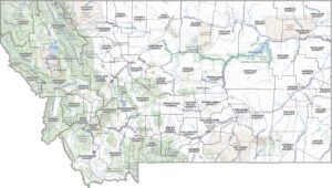

We allow you to use our Montana County map. Attribution is required.
Montana County Maps
Spanning the vast expanse of Big Sky Country are 56 counties, each with its own piece of Montana’s diverse landscape. Click on a map below for a more detailed view.


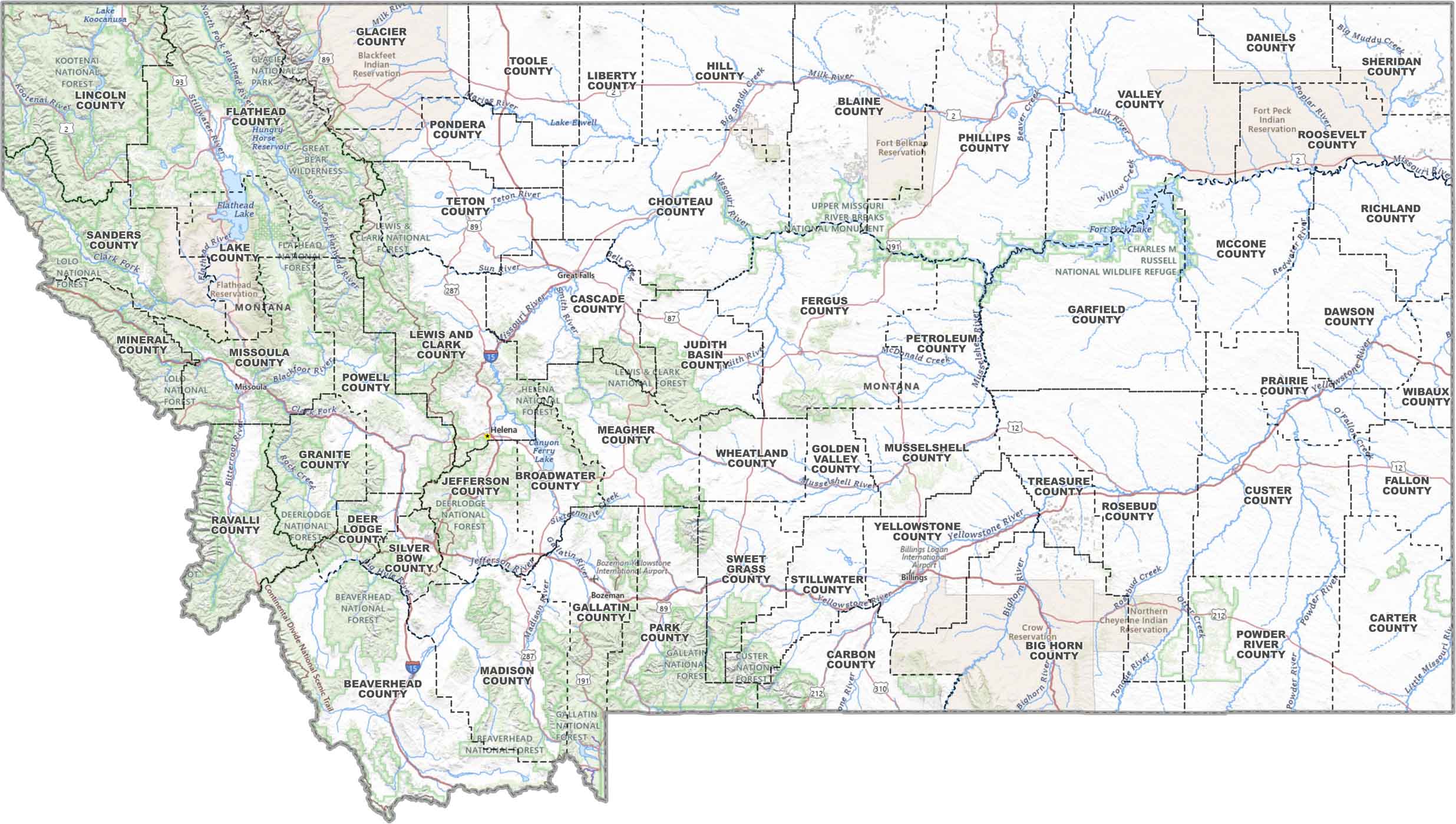
PHYSICAL MAP
Montana Topographic County Map
Montana’s a big place, and this map keeps things organized. You’ll find county borders, main roads, rivers, lakes, reservations, and much more.
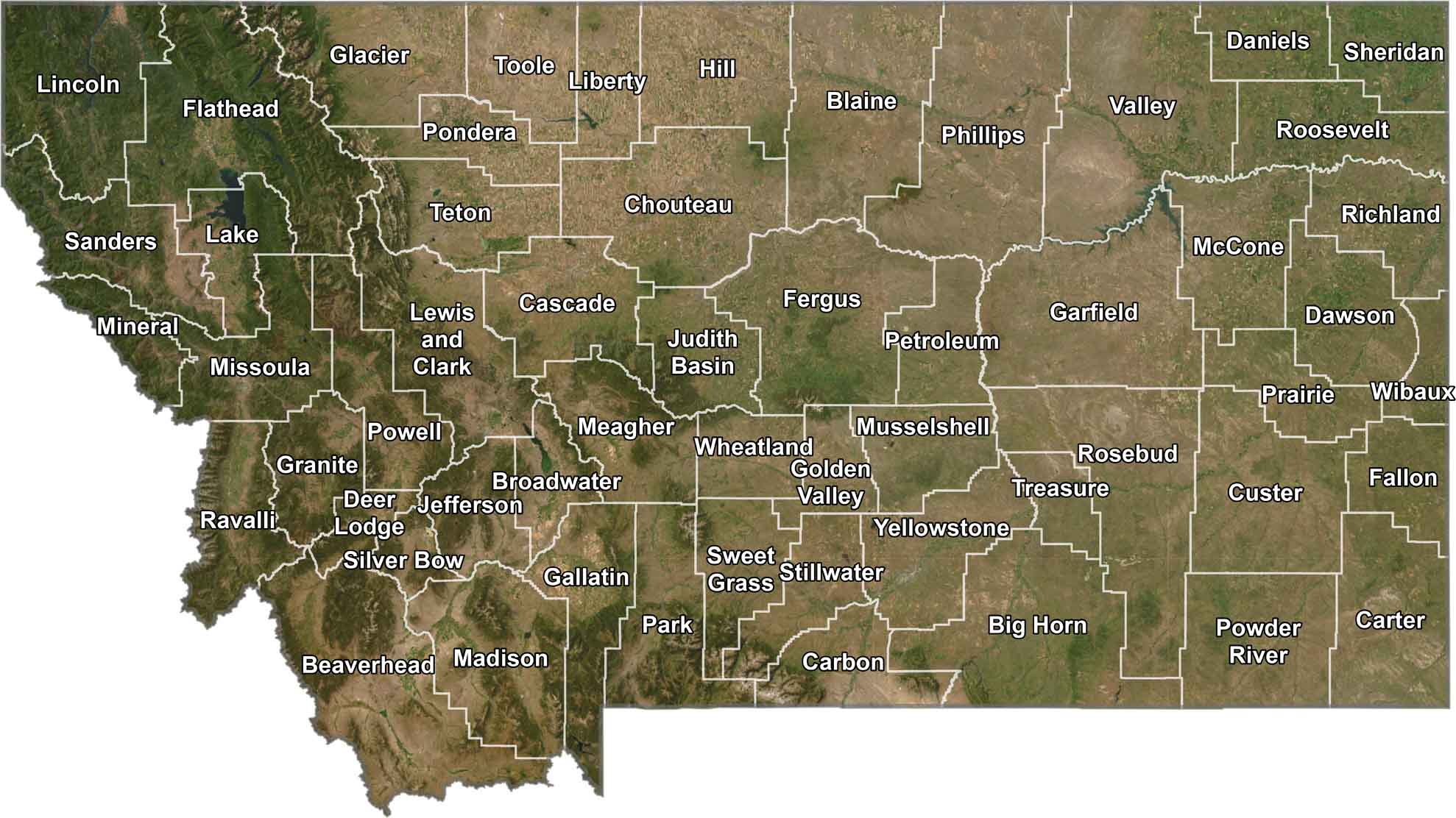
SATELLITE IMAGERY
Montana Satellite County Map
Seen from above, Montana looks just as wide and wild as you’d expect. It has mountains, plains, and barely a city in sight. This satellite view keeps it real and adds county outlines so you can make sense of it all.
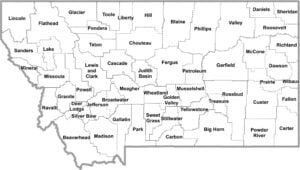
OUTLINE MAP
Montana Simple County Map
No extras, no fuss. Just a straightforward map of Montana’s counties, each one labeled and easy to spot. Quick and to the point.

Montana Counties
In Montana, Yellowstone County stands out as the most populous. This is largely thanks to Billings, Montana’s largest city. As for the least people, there’s Petroleum County with fewer residents than some apartment buildings. Why so few? Well, it’s mostly ranch land, and let’s just say the oil boom its name hinted at never really panned out.
Most Populous: Yellowstone County
Least Populous: Petroleum County

When it comes to size, Beaverhead County takes the cake. It’s massive, covering more ground than the entire state of Connecticut. What is the smallest county? That’d be Silver Bow County, if you’re just looking at landmass. Deer Lodge County is actually smallest if you include the areas with water.
Largest Area: Beaverhead County
Smallest Area: Silver Bow County
Montana’s counties have some interesting stories behind their names. Treasure County is not named for any actual treasure, but for the fertile farmland early settlers saw as agricultural gold. Or how about Powder River County? Its name comes from the river that runs through it, which often runs so low it looks like a “river of powder”.
Montana County List
Here’s a complete list of Montana counties, with key statistics for each:
| FIPS Code | Name | Land % | Water % | Total Area (sq mi) |
|---|---|---|---|---|
| 30-001 | Beaverhead County | 99.5 | 0.5 | 5,572.9 |
| 30-003 | Big Horn County | 99.6 | 0.4 | 5,016.1 |
| 30-005 | Blaine County | 99.7 | 0.3 | 4,238.3 |
| 30-007 | Broadwater County | 96.3 | 3.7 | 1,238.1 |
| 30-009 | Carbon County | 99.3 | 0.7 | 2,061.4 |
| 30-011 | Carter County | 99.8 | 0.2 | 3,348.0 |
| 30-013 | Cascade County | 99.5 | 0.5 | 2,711.4 |
| 30-015 | Chouteau County | 99.4 | 0.6 | 3,996.7 |
| 30-017 | Custer County | 99.7 | 0.3 | 3,793.2 |
| 30-019 | Daniels County | 100.0 | 0.0 | 1,426.4 |
| 30-021 | Dawson County | 99.5 | 0.5 | 2,383.5 |
| 30-023 | Deer Lodge County | 99.4 | 0.6 | 741.4 |
| 30-025 | Fallon County | 99.9 | 0.1 | 1,622.8 |
| 30-027 | Fergus County | 99.8 | 0.2 | 4,350.0 |
| 30-029 | Flathead County | 96.8 | 3.2 | 5,256.0 |
| 30-031 | Gallatin County | 98.9 | 1.1 | 2,633.8 |
| 30-033 | Garfield County | 96.4 | 3.6 | 4,849.1 |
| 30-035 | Glacier County | 98.7 | 1.3 | 3,035.9 |
| 30-037 | Golden Valley County | 99.9 | 0.1 | 1,175.4 |
| 30-039 | Granite County | 99.7 | 0.3 | 1,732.8 |
| 30-041 | Hill County | 99.4 | 0.6 | 2,916.4 |
| 30-043 | Jefferson County | 99.8 | 0.2 | 1,659.4 |
| 30-045 | Judith Basin County | 100.0 | 0.0 | 1,870.5 |
| 30-047 | Lake County | 90.1 | 9.9 | 1,654.0 |
| 30-049 | Lewis and Clark County | 98.9 | 1.1 | 3,497.5 |
| 30-051 | Liberty County | 98.8 | 1.2 | 1,447.1 |
| 30-053 | Lincoln County | 98.3 | 1.7 | 3,674.9 |
| 30-055 | McCone County | 98.5 | 1.5 | 2,682.0 |
| 30-057 | Madison County | 99.6 | 0.4 | 3,603.5 |
| 30-059 | Meagher County | 99.9 | 0.1 | 2,394.7 |
| 30-061 | Mineral County | 99.7 | 0.3 | 1,223.4 |
| 30-063 | Missoula County | 99.0 | 1.0 | 2,617.9 |
| 30-065 | Musselshell County | 99.9 | 0.1 | 1,871.7 |
| 30-067 | Park County | 99.6 | 0.4 | 2,813.2 |
| 30-069 | Petroleum County | 98.9 | 1.1 | 1,674.5 |
| 30-071 | Phillips County | 98.6 | 1.4 | 5,212.1 |
| 30-073 | Pondera County | 99.0 | 1.0 | 1,641.5 |
| 30-075 | Powder River County | 100.0 | 0.0 | 3,298.8 |
| 30-077 | Powell County | 99.7 | 0.3 | 2,332.3 |
| 30-079 | Prairie County | 99.7 | 0.3 | 1,742.4 |
| 30-081 | Ravalli County | 99.6 | 0.4 | 2,400.3 |
| 30-083 | Richland County | 99.1 | 0.9 | 2,103.3 |
| 30-085 | Roosevelt County | 99.4 | 0.6 | 2,369.2 |
| 30-087 | Rosebud County | 99.7 | 0.3 | 5,025.2 |
| 30-089 | Sanders County | 98.9 | 1.1 | 2,789.9 |
| 30-091 | Sheridan County | 98.3 | 1.7 | 1,704.8 |
| 30-093 | Silver Bow County | 99.9 | 0.1 | 718.6 |
| 30-095 | Stillwater County | 99.5 | 0.5 | 1,805.9 |
| 30-097 | Sweet Grass County | 99.6 | 0.4 | 1,862.3 |
| 30-099 | Teton County | 99.1 | 0.9 | 2,291.9 |
| 30-101 | Toole County | 98.5 | 1.5 | 1,945.1 |
| 30-103 | Treasure County | 99.3 | 0.7 | 984.4 |
| 30-105 | Valley County | 97.3 | 2.7 | 5,061.8 |
| 30-107 | Wheatland County | 99.6 | 0.4 | 1,427.5 |
| 30-109 | Wibaux County | 99.9 | 0.1 | 889.3 |
| 30-111 | Yellowstone County | 99.4 | 0.6 | 2,648.9 |
Source: United States Census Bureau