New Jersey County Map

New Jersey County Map Collection

We allow you to use our New Jersey County map. Attribution is required.
New Jersey County Maps
New Jersey is carved up into 21 counties with a large mixture of geographies. See for yourself by clicking a map below.


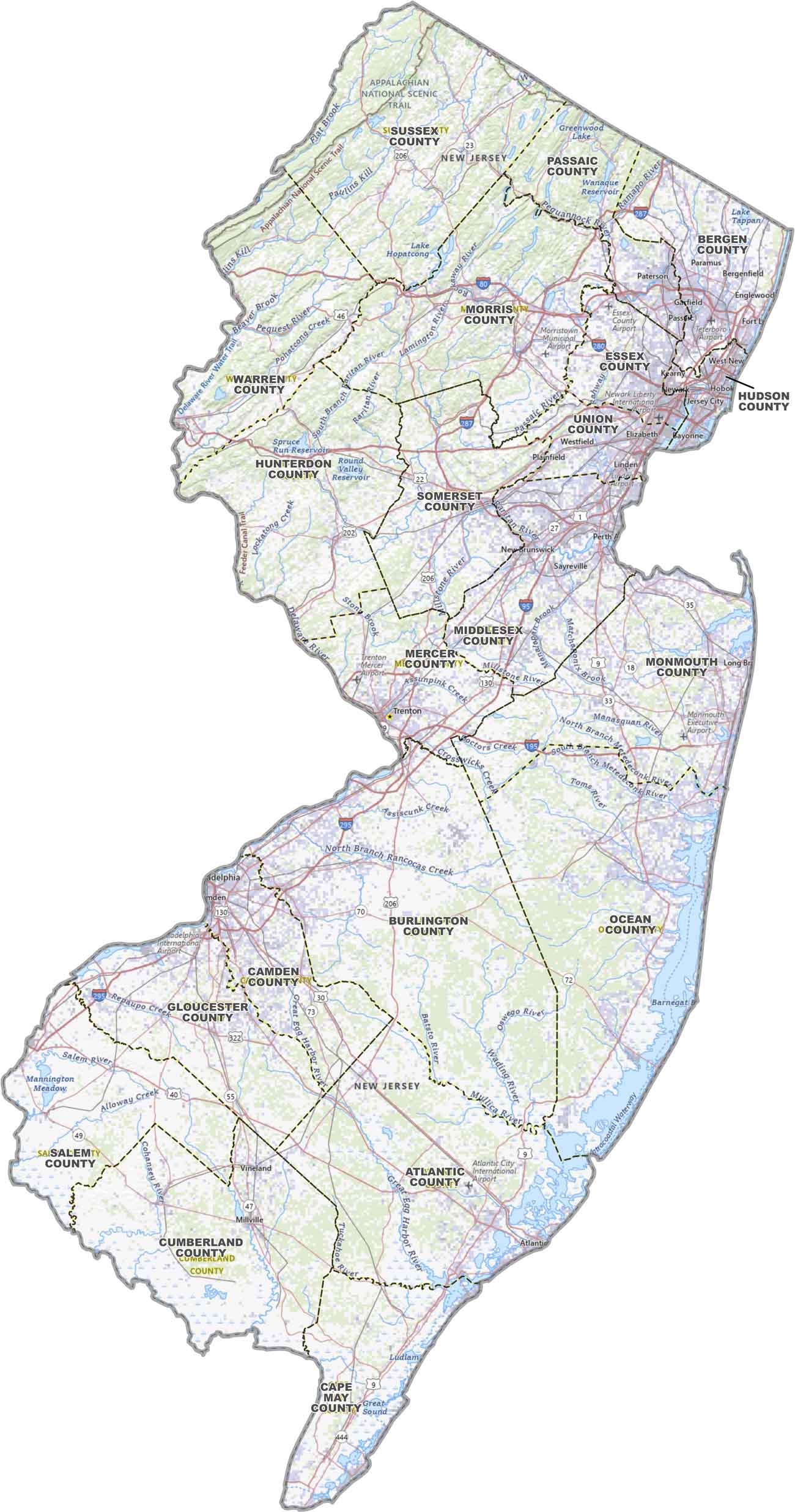
PHYSICAL MAP
New Jersey Topographic County Map
North Jersey, South Jersey, and everything in between. Our topographic map lays it out with all the county boundaries and labels of New Jersey.
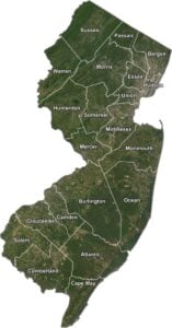
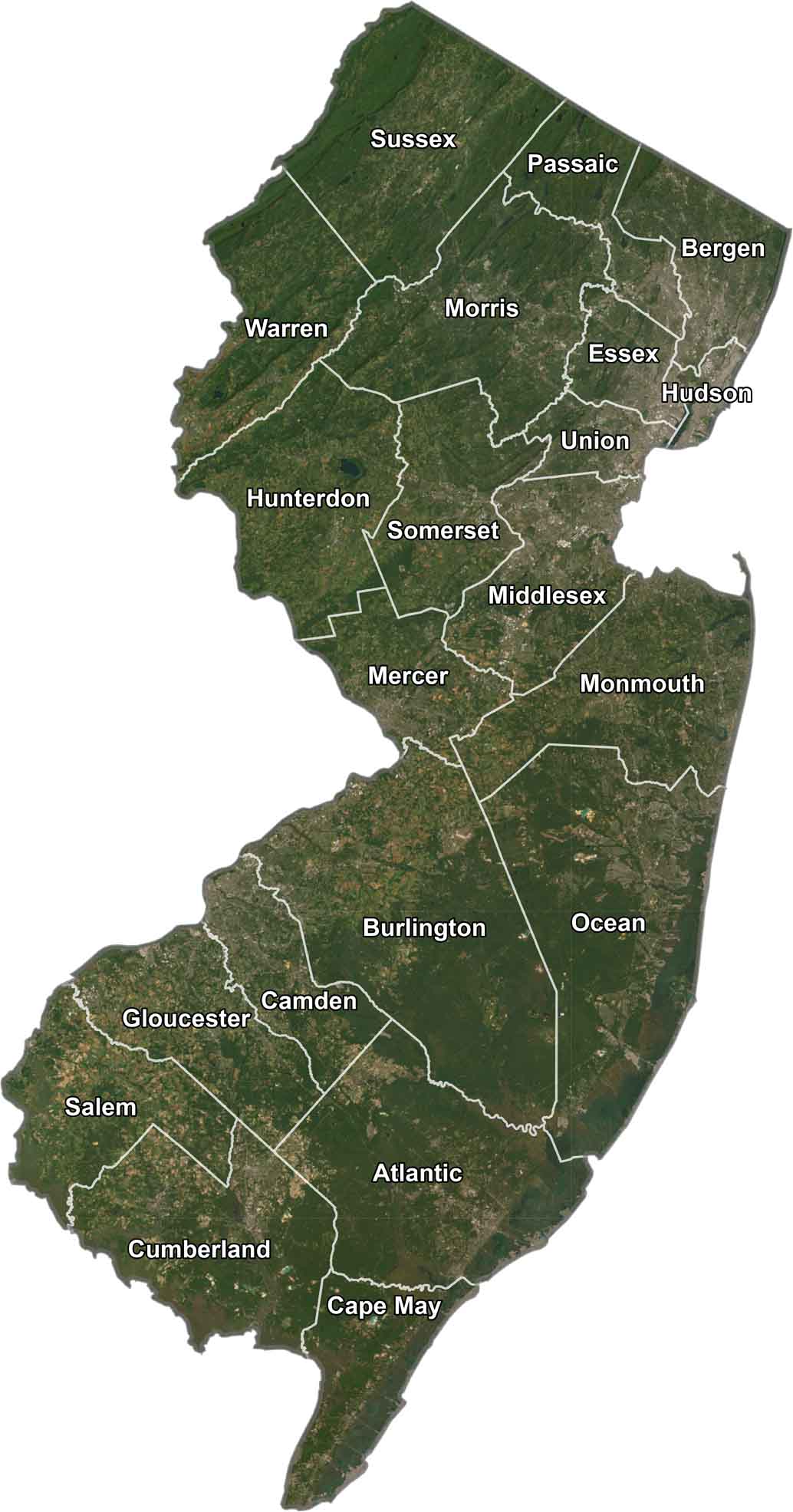
SATELLITE IMAGERY
New Jersey Satellite County Map
Zoom out and Jersey tells a different story. You’ll see a lot of forests with urban areas and coastlines too. Our satellite imagery captures it all with county outlines.
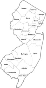
OUTLINE MAP
New Jersey Simple County Map
This simple map only has the lines that divide the state. This bare-bones New Jersey county map keeps it clean and simple all the way to Cape May.

New Jersey Counties
Here in New Jersey, Essex County is the most populated. It’s home to Newark, the state’s largest city, and a bunch of densely packed suburbs. As for least populated, there’s Salem County down in the southwest corner. It’s mostly farmland here.
Most Populous: Essex County
Least Populous: Salem County

In terms of land area, Burlington County is the biggest, situated in the center of the state The smallest county is Hudson County, right across the river from New York City. It might be tiny, but it packs a punch with cities like Jersey City and Hoboken.
Largest Area: Burlington County
Smallest Area: Hudson County
New Jersey’s counties have interesting origins. Cape May County was named after a Dutch explorer, Cornelius Jacobsen Mey, who sailed into Delaware Bay back in the 1620s. There’s also Bergen County. This is the oldest county in the state, established way back in 1683 when New Jersey was still an English colony.
New Jersey County List
Take a look at our complete list of New Jersey counties with land, water and total areas:
| FIPS Code | Name | Land % | Water % | Total Area (sq mi) |
|---|---|---|---|---|
| 34-001 | Atlantic County | 82.7 | 17.3 | 671.8 |
| 34-003 | Bergen County | 94.5 | 5.5 | 246.4 |
| 34-005 | Burlington County | 97.5 | 2.5 | 820.2 |
| 34-007 | Camden County | 97.3 | 2.7 | 227.4 |
| 34-009 | Cape May County | 40.5 | 59.5 | 620.3 |
| 34-011 | Cumberland County | 71.3 | 28.7 | 677.8 |
| 34-013 | Essex County | 97.4 | 2.6 | 129.4 |
| 34-015 | Gloucester County | 95.6 | 4.4 | 336.8 |
| 34-017 | Hudson County | 74.0 | 26.0 | 62.4 |
| 34-019 | Hunterdon County | 97.8 | 2.2 | 437.4 |
| 34-021 | Mercer County | 98.1 | 1.9 | 228.9 |
| 34-023 | Middlesex County | 95.8 | 4.2 | 322.9 |
| 34-025 | Monmouth County | 70.4 | 29.6 | 665.5 |
| 34-027 | Morris County | 95.6 | 4.4 | 481.5 |
| 34-029 | Ocean County | 68.7 | 31.3 | 914.8 |
| 34-031 | Passaic County | 93.8 | 6.2 | 198.4 |
| 34-033 | Salem County | 89.1 | 10.9 | 372.5 |
| 34-035 | Somerset County | 99.0 | 1.0 | 305.0 |
| 34-037 | Sussex County | 96.9 | 3.1 | 535.4 |
| 34-039 | Union County | 97.4 | 2.6 | 105.5 |
| 34-041 | Warren County | 98.3 | 1.7 | 362.6 |
Source: United States Census Bureau