Teton County Map, Wyoming

Teton County Map Collection
We allow you to use our Teton County map. Attribution is required.
Teton County, Wyoming

Teton County is Wyoming’s crown jewel. Located in the northwestern corner of the state, it’s home to Grand Teton National Park and part of Yellowstone.
The Tetons themselves are a sight to behold. They’re jagged peaks that seem to pierce the sky. Jackson Hole is the place to be, whether you’re into skiing, hiking, or just soaking up the mountain vibes.
Wildlife is everywhere. Elk, moose, and bison roam freely. The Snake River winds through the valley, perfect for rafting or fishing. It’s not all wilderness though. The town of Jackson has a thriving arts scene and some seriously good restaurants. If you love the outdoors, this is paradise.
| Category | Details |
|---|---|
| County Name | Teton County |
| County Seat | Jackson |
| Population | Approximately 25,000 |
| Cities, Towns, and Communities | Jackson, Teton Village, Wilson, Moose, Hoback Junction |
| Interstates and Highways | US-26, US-89, US-191 |
| FIPS Code | 56-039 |
| Total Area (Land and Water) | 4,216 sq mi (Land: 3,995 sq mi; Water: 221 sq mi) |
| Adjacent Counties (and Direction) | Park County (Northeast), Fremont County (East), Sublette County (Southeast), Lincoln County (South), Bonneville County, Idaho (Southwest), Teton County, Idaho (Southwest), Fremont County, Idaho (West), Gallatin County, Montana (Northwest) |
| Time Zone | Mountain Time Zone (MT) |
| State | Wyoming |
| Coordinates | 43.8527° N, 110.5885° W |
| Etymology | Named after the Teton Range in the Rocky Mountains |
| Major Landmarks | Grand Teton National Park, Jackson Hole Mountain Resort, National Elk Refuge |
| Website | Teton County Website |
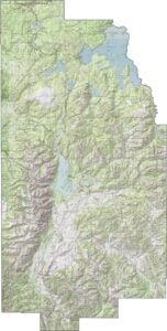
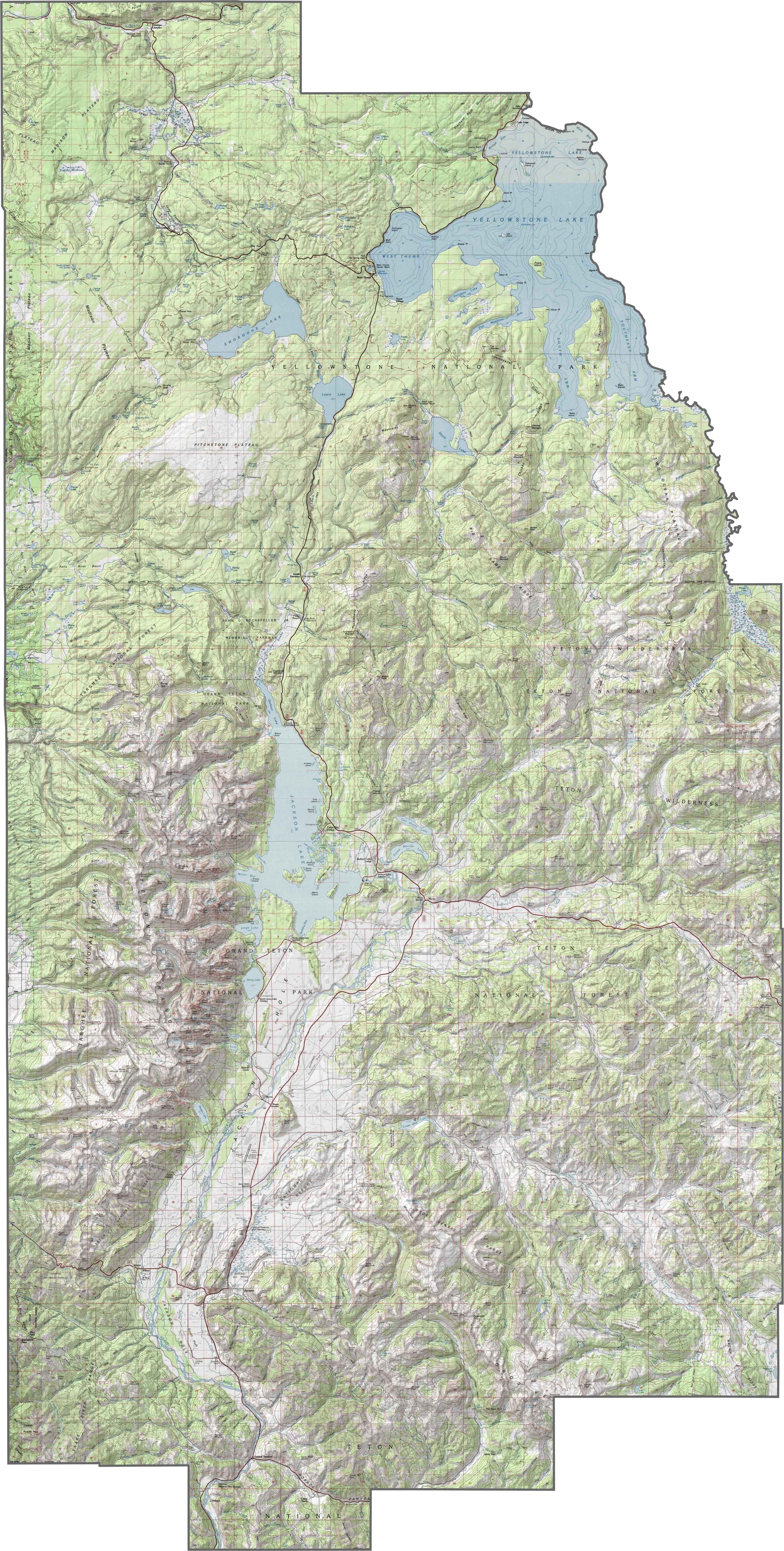
PHYSICAL MAP
Teton County Topographic Map
This county is defined by elevation. The Teton Range towers over everything, with Grand Teton soaring above 13,000 feet. In contrast, the Jackson Hole valley lies in the shadows, broad and flat but still over a mile high.
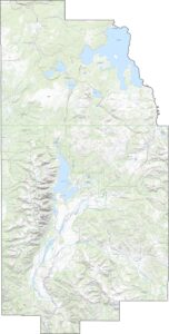
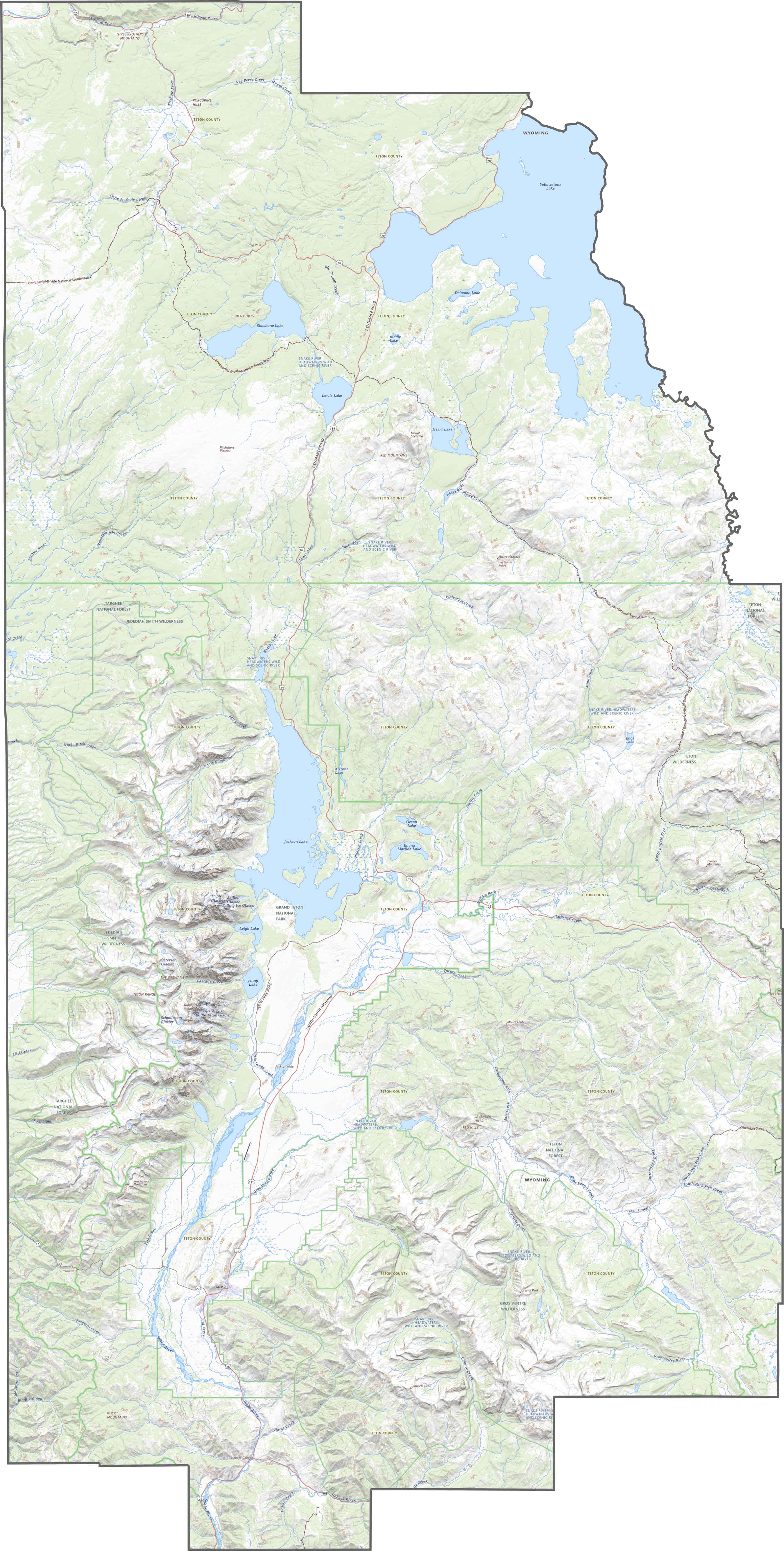
TRANSPORTATION MAP
Teton County Road Map
Despite the rugged terrain, a few highways manage to pass through. They curve around mountains and cross alpine passes. There’s no interstate here, but U.S. highways link Jackson to the outside world.
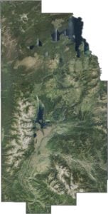
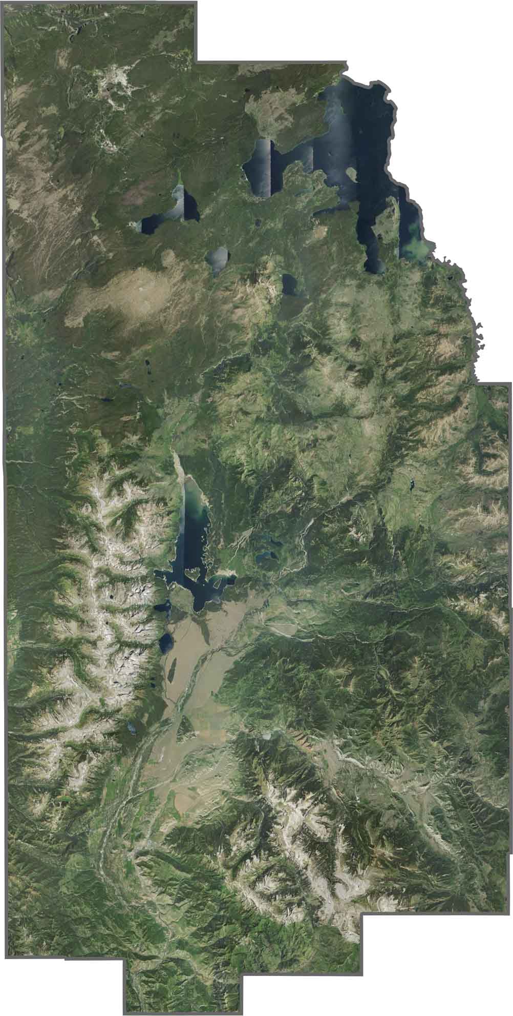
SATELLITE IMAGERY
Teton County Satellite Map
The Tetons are unmistakable… sharp, snowy, and dramatic. Jackson is a small town tucked beside forested hills. Much of the land is national park or forest, so our satellite image has a lot of green, brown, and white with only occasional signs of development.
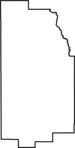
OUTLINE MAP
Teton County Blank Map
Teton County has a rugged, uneven shape defined by natural borders. It borders Idaho on the west and Montana in the northwest. Its northeastern border follows partly Yellowstone Lake.

Neighboring Counties
Here are the 8 neighboring counties of Teton County:


Wyoming County Map

Get ready for wide skies and long drives. Wyoming’s 23 counties don’t do crowded. But what I do know is that it’s big, it’s bold, and it doesn’t try to impress you. It comes naturally.