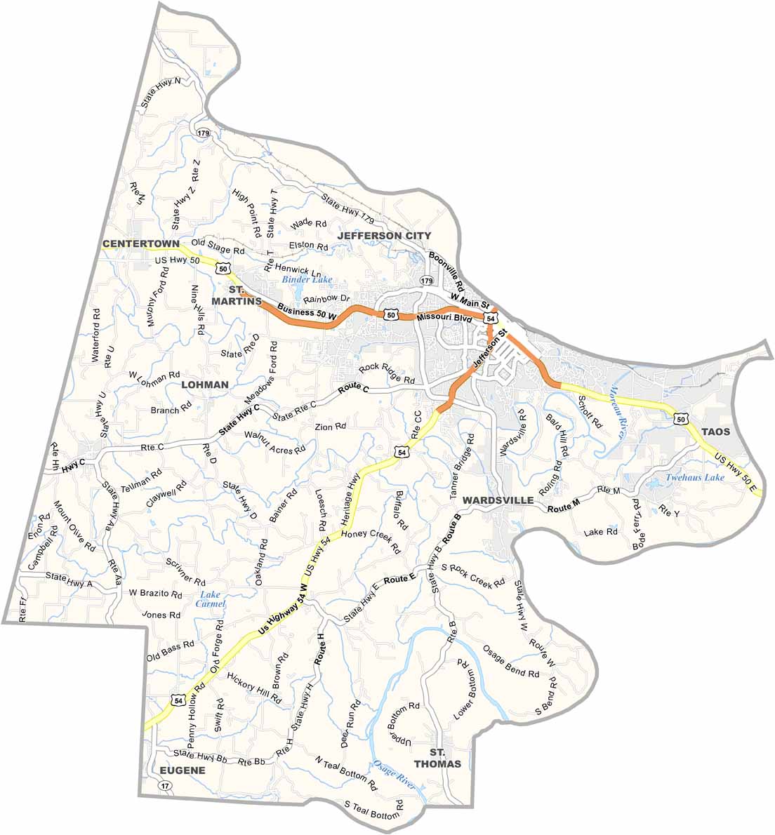
Cole County Map, Missouri
We allow you to use our Cole County map. Attribution is required.
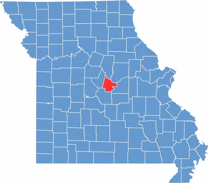
Cole County, Missouri
Jefferson City, the state capital, sits right in the heart of Cole County. This place has been Missouri’s seat of government since 1826. The impressive Capitol building dominates the skyline, its dome visible for miles.
Cole County is in the middle of the state, straddling the Missouri River. It’s not all politics here though. Locals love to hike the Katy Trail on weekends.
As you exit the urban areas, farm fields give way to city streets. Come here to enjoy the crisp air and high school football games under Friday night lights.
| Category | Details |
|---|---|
| County Name | Cole County |
| County Seat | Jefferson City |
| Population | Approximately 80,000 |
| Cities, Towns, and Communities | Jefferson City, Taos, Wardsville, St. Martins, Lohman, Centertown, Russellville, St. Thomas |
| Interstates and Highways | US-50, US-54, US-63, MO-179 |
| FIPS Code | 29-051 |
| Total Area (Land and Water) | 402 sq mi (land: 394 sq mi, water: 8 sq mi) |
| Adjacent Counties (and Direction) | Boone County (North), Callaway County (Northeast), Osage County (Southeast), Miller County (Southwest), Moniteau County (Northwest) |
| Time Zone | Central Time Zone (CST) |
| State | Missouri |
| Coordinates | 38.5012° N, 92.2530° W |
| Etymology | Named after Stephen Cole, an early settler of the region |
| Major Landmarks | Missouri State Capitol, Governor’s Mansion, Missouri State Penitentiary Museum |
| Website | Cole County Website |
Missouri County Maps
Get to know all the counties in Missouri with our map collection.


