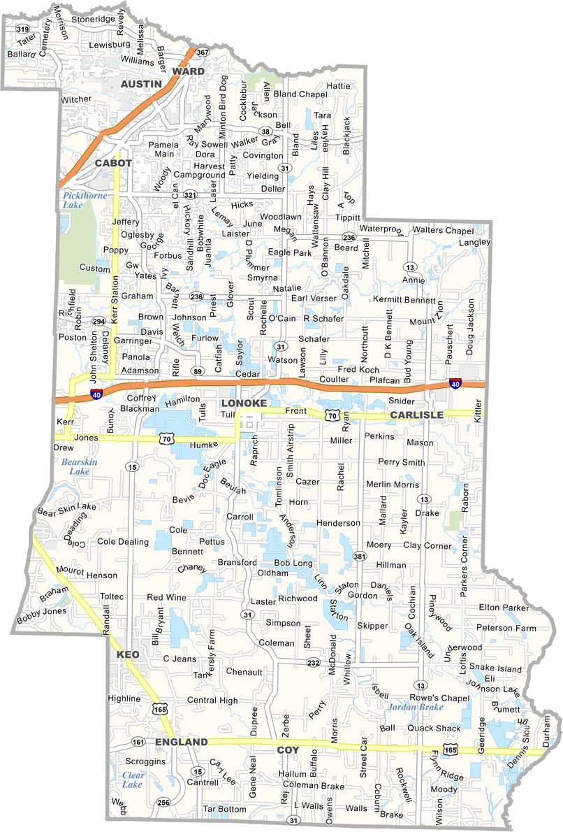
Lonoke County Map, Arkansas
We allow you to use our Lonoke County map. Attribution is required.
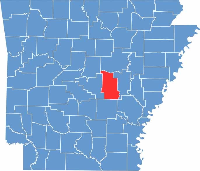
Lonoke County, Arkansas
Lonoke County stretches from the edge of Little Rock’s suburbs into the Grand Prairie region of eastern Arkansas. The county seat is also named Lonoke and was laid out in a perfect circle around a central park.
Agriculture is a major industry here. Rice and soybeans are the key crops. The Joe Hogan Fish Hatchery in Lonoke is the largest state-owned warmwater fish hatchery in the U.S.
In Lonoke County, you can also enjoy Holland Bottoms State Wildlife Management Area. Despite its proximity to Little Rock, it’s both suburban convenience and country living. That’s why population growth has only increased here.
| Category | Details |
|---|---|
| County Name | Lonoke County |
| County Seat | Lonoke |
| Population | Approximately 78,000 |
| Cities, Towns, and Communities | Cabot, Lonoke, Carlisle, Ward, England, Austin, Allport, Coy, Keo |
| Interstates and Highways | Interstate 40, U.S. Route 67, U.S. Route 70, State Route 31, State Route 38, State Route 89 |
| FIPS Code | 05-085 |
| Total Area (Land and Water) | 803 square miles (Land: 771 sq mi, Water: 32 sq mi) |
| Adjacent Counties (and Direction) | White County (North), Prairie County (East), Arkansas County (Southeast), Jefferson County (South), Pulaski County (West), Faulkner County (Northwest) |
| Time Zone | Central Standard Time (CST) |
| State | Arkansas |
| Coordinates | 34.7536° N, 91.8996° W |
| Etymology | Named after the Lone Oak tree that stood on the original town site |
| Major Landmarks | Toltec Mounds Archeological State Park, Joe Hogan State Fish Hatchery, Lonoke County Courthouse, Holland Bottoms State Wildlife Management Area |
Arkansas County Maps
Get to know all the counties in Arkansas with our map collection.


