Thayer County Map, Nebraska
We allow you to use our Thayer County map. Attribution is required.
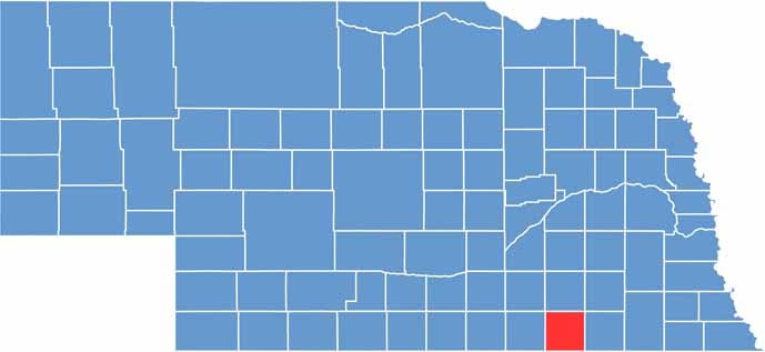
Thayer County, Nebraska
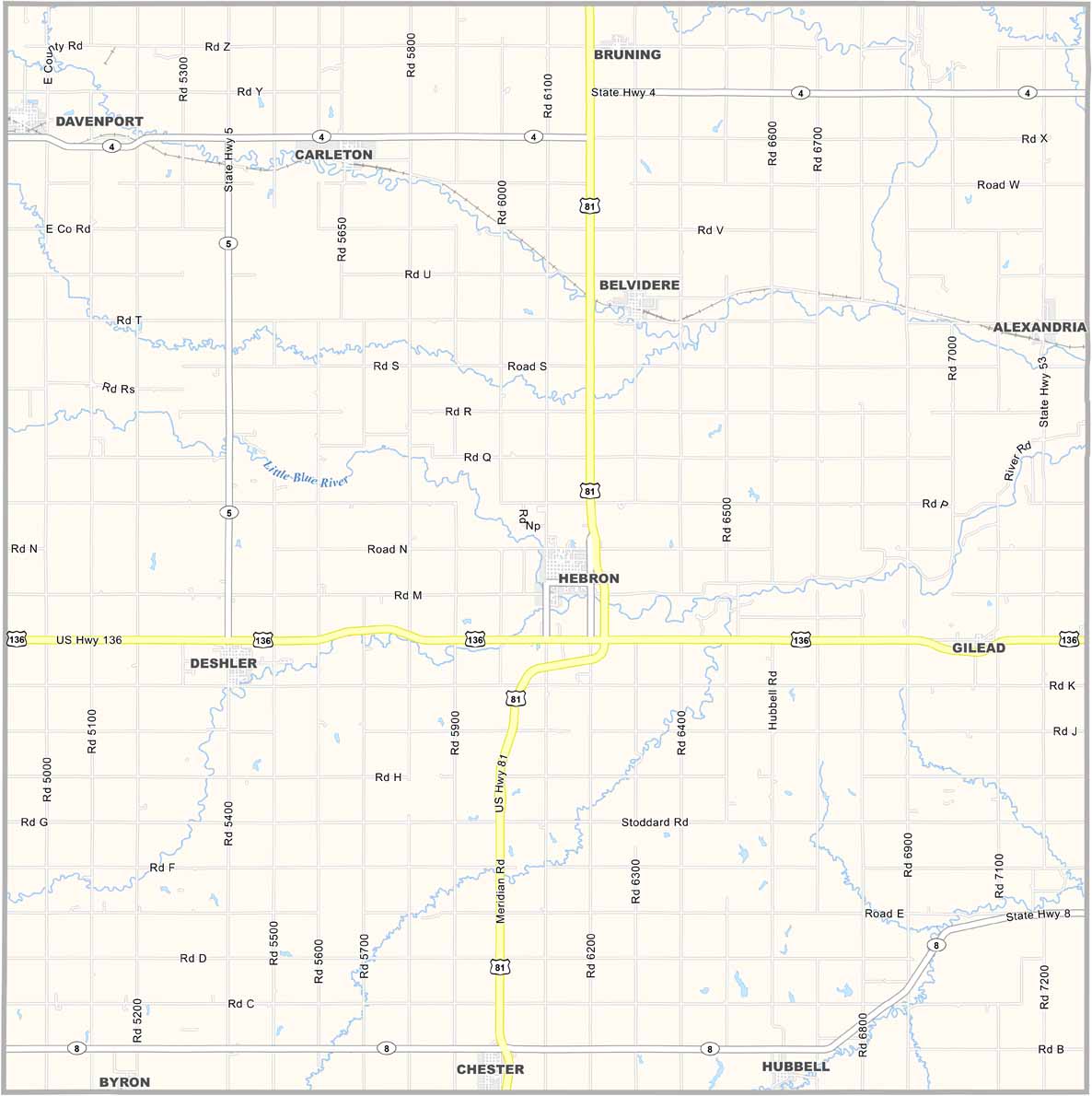
Thayer County sits down in south-central Nebraska, right on the Kansas border. Hebron is the county seat. The county’s mostly farmland.
They’ve got the world’s largest porch swing in Hebron. It has a seat that’s 32 feet long. No kidding. It’s in the Guinness Book of World Records.
The population’s been shrinking for years. But those who stay are deeply attached to the land. The Little Blue River runs through here and it creates some nice spots for fishing and camping.
| Category | Details |
|---|---|
| County Name | Thayer County |
| County Seat | Hebron |
| Population | Approximately 5,200 |
| Cities, Towns, and Communities | Hebron, Deshler, Chester, Hubbell, Alexandria, Belvidere, Carleton, Byron |
| Interstates and Highways | U.S. Highway 81, Nebraska Highway 4, Nebraska Highway 8 |
| FIPS Code | 31-169 |
| Total Area (Land and Water) | 575 square miles (574 sq mi land, 1 sq mi water) |
| Adjacent Counties (and Direction) | Saline County (Northeast), Jefferson County (East), Washington County, Kansas (Southeast), Republic County, Kansas (South), Nuckolls County (West), Fillmore County (North) |
| Time Zone | Central Time Zone (CT) |
| State | Nebraska |
| Coordinates | 40.1686° N, 97.5912° W |
| Etymology | Named after John Milton Thayer, a U.S. Senator and Governor of Nebraska |
| Major Landmarks | Hebron Historic District, Rock Creek Station State Historical Park |
| Website | Thayer County Website |
Nebraska County Maps
Get to know all the counties in Nebraska with our map collection.


