Washington County Map, Texas
We allow you to use our Washington County map. Attribution is required.
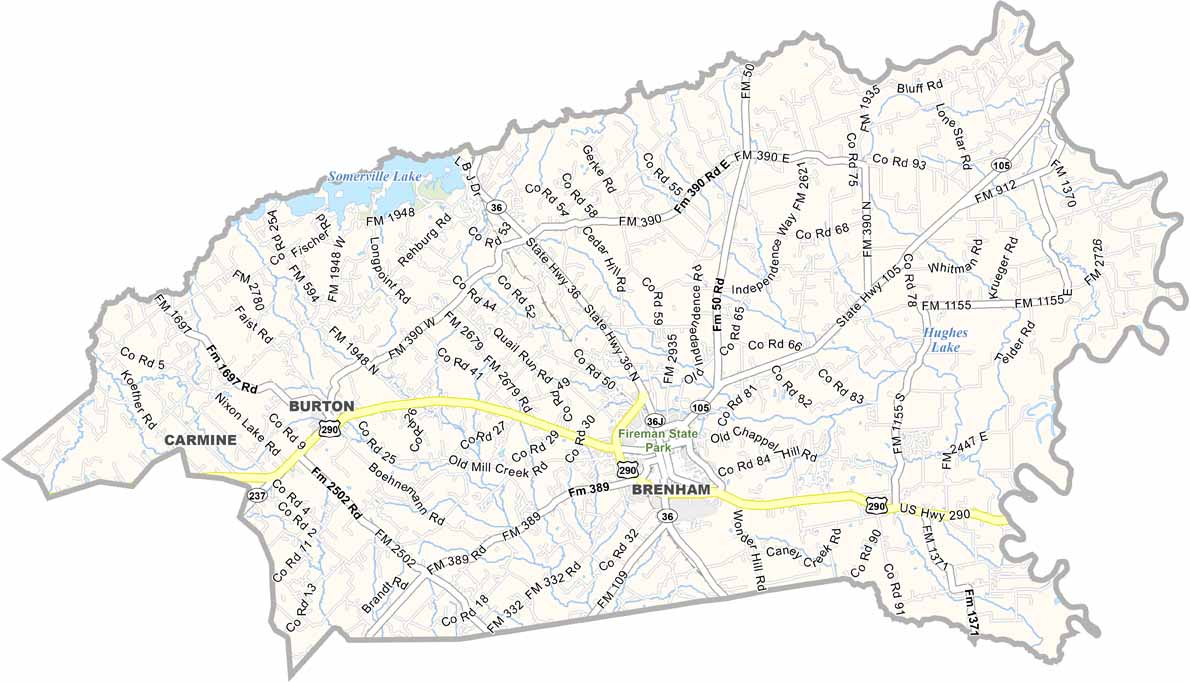
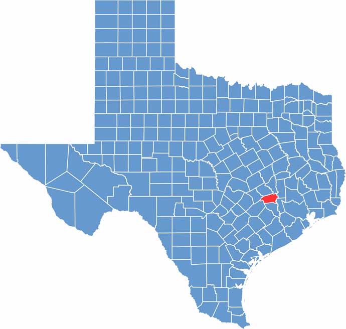
Washington County, Texas
You want to talk about Texas history? Let’s talk Washington County. This is where Texas was born. Literally. Washington-on-the-Brazos, where the Texas Declaration of Independence was signed, is here.
You’ll find this county in south-central Texas, halfway between Houston and Austin. Brenham, the county seat, is famous for Blue Bell Ice Cream. Yum! The landscape is pure Texas Hill Country. Rolling hills.
Wildflowers in spring. Live oak trees. Ranching and farming are still big here. But tourism is growing. People come for the history. They stay for the charm. The small towns. The friendly folks. Washington County is Texas in a nutshell.
| Category | Details |
|---|---|
| County Name | Washington County |
| County Seat | Brenham |
| Population | Approximately 35,000 |
| Cities, Towns, and Communities | Brenham, Burton, Washington |
| Interstates and Highways | U.S. Highway 290, State Highway 105 |
| FIPS Code | 48-477 |
| Total Area (Land and Water) | 715 square miles (709 sq mi land, 6 sq mi water) |
| Adjacent Counties (and Direction) | Brazos County (North), Grimes County (Northeast), Waller County (East), Austin County (South), Fayette County (Southwest), Lee County (West), Burleson County (Northwest) |
| Time Zone | Central Time Zone (CST) |
| State | Texas |
| Coordinates | 30°10’N, 96°25’W |
| Etymology | Named after George Washington, the first President of the United States |
| Major Landmarks | Brenham’s Blue Bell Creameries, Washington-on-the-Brazos State Historic Site |
| Website | Washington County Website |
Texas County Maps
Get to know all the counties in Texas with our map collection.


