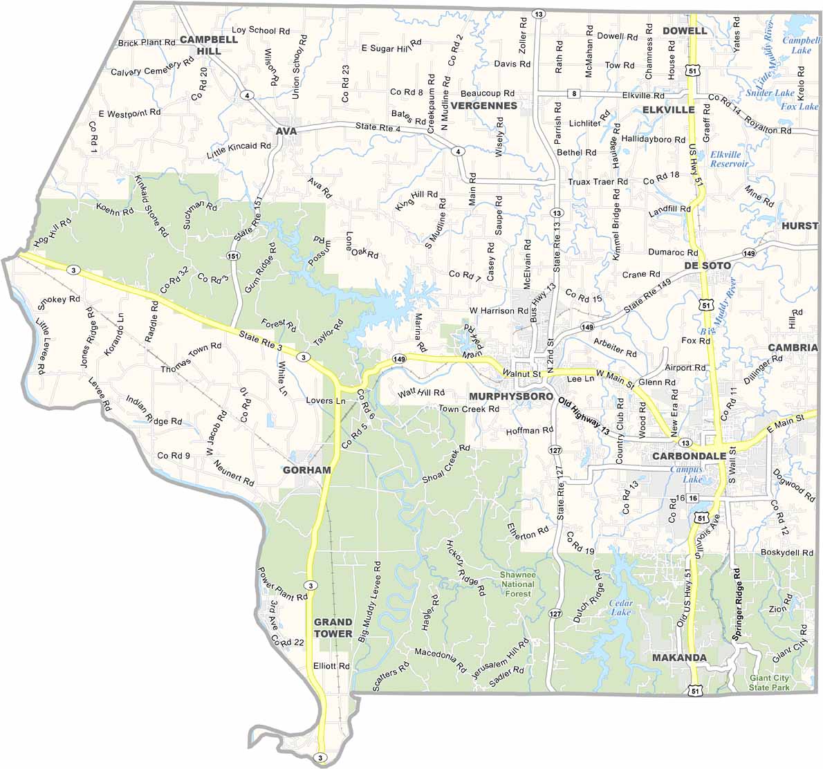
Jackson County Map, Illinois
We allow you to use our Jackson County map. Attribution is required.
Jackson County, Illinois

Jackson County sits in southern Illinois, where the cornfields start giving way to hills and forests. Carbondale is the biggest town, home to Southern Illinois University. But Murphysboro is the county seat, famous for its barbecue.
The Shawnee National Forest covers a good chunk of the county in the south. You’ve got a mix of students, professors, farmers, and miners here. The wineries are starting to make a name for themselves.
There’s a Life Skills Re-Entry Center in Murphysboro. The country is more diverse than you might expect for rural Illinois. On game days, everyone’s decked out in Saluki maroon.
| Category | Details |
|---|---|
| County Name | Jackson County |
| County Seat | Murphysboro |
| Population | Approximately 52,000 |
| Cities, Towns, and Communities | Carbondale, Murphysboro, Ava, De Soto, Elkville, Makanda, Grand Tower, Campbell Hill, Gorham, Vergennes, and various other unincorporated communities. |
| Interstates and Highways | Interstate 57, U.S. Highway 51, Illinois Route 13, Illinois Route 127, Illinois Route 149 |
| FIPS Code | 17-077 |
| Total Area (Land and Water) | 603 square miles (land: 584 sq mi, water: 19 sq mi) |
| Adjacent Counties (and Direction) | Perry County (North), Franklin County (Northeast), Williamson County (East), Union County (South), Cape Girardeau County, Missouri (Southwest), Perry County, Missouri (West), Randolph County (Northwest) |
| Time Zone | Central Time Zone (CT) |
| State | Illinois |
| Coordinates | 37.7650° N, 89.3360° W |
| Etymology | Named after Andrew Jackson, the seventh President of the United States |
| Major Landmarks | Shawnee National Forest, Giant City State Park, Pomona Natural Bridge, Kinkaid Lake, Southern Illinois University Carbondale |
| Website | Jackson County Website |
Illinois County Maps
Get to know all the counties in Illinois with our map collection.


