Mississippi County Map

Mississippi County Map Collection
We allow you to use our Mississippi County map. Attribution is required.
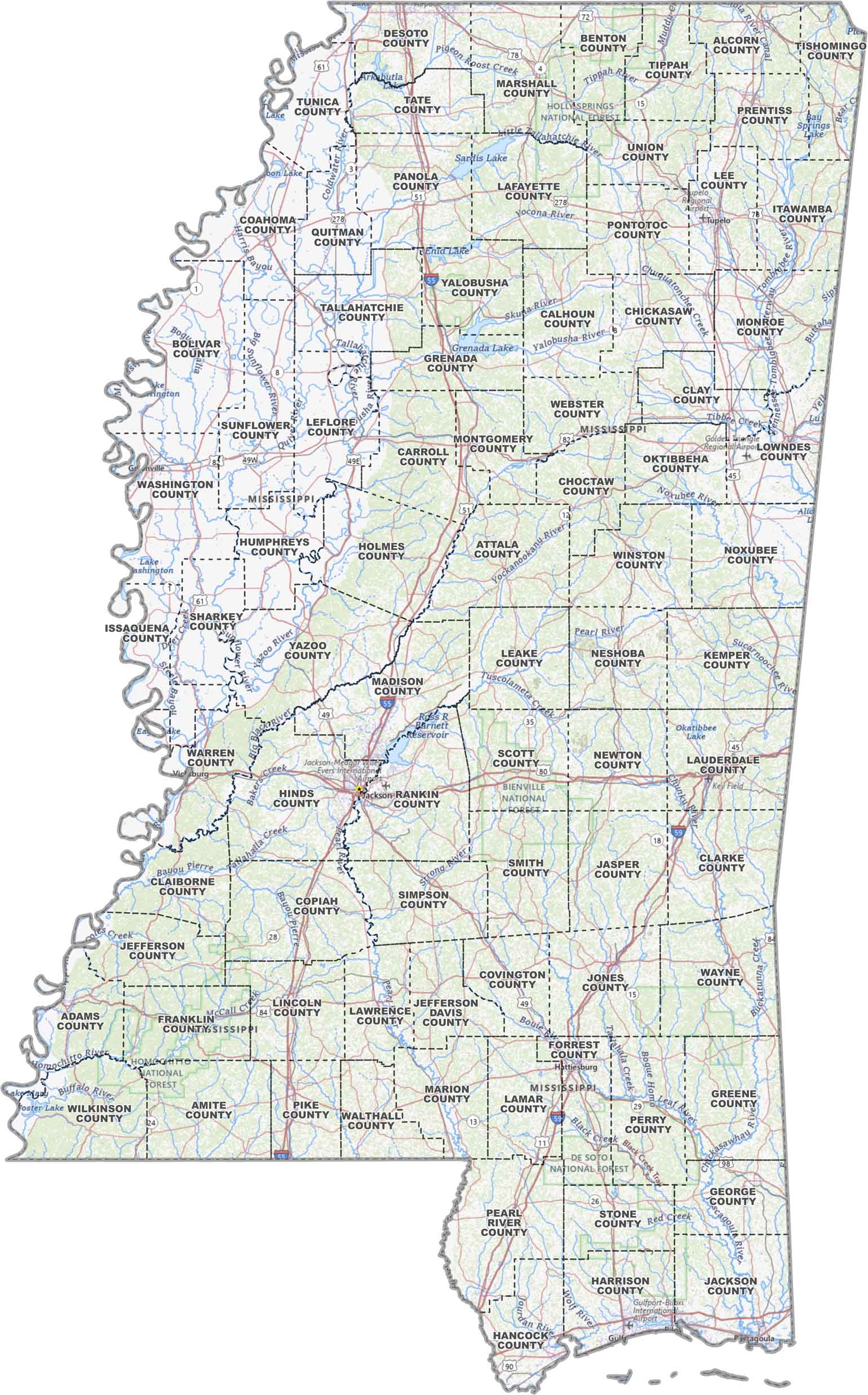
Mississippi County Maps
Mississippi is carved up into 82 counties. Click on a map below to explore it in more detail.


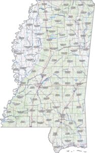
PHYSICAL MAP
Mississippi Topographic County Map
Here’s a solid overview map of Mississippi. Counties are marked, main roads are in place, and water features are highlighted.
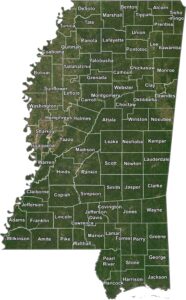
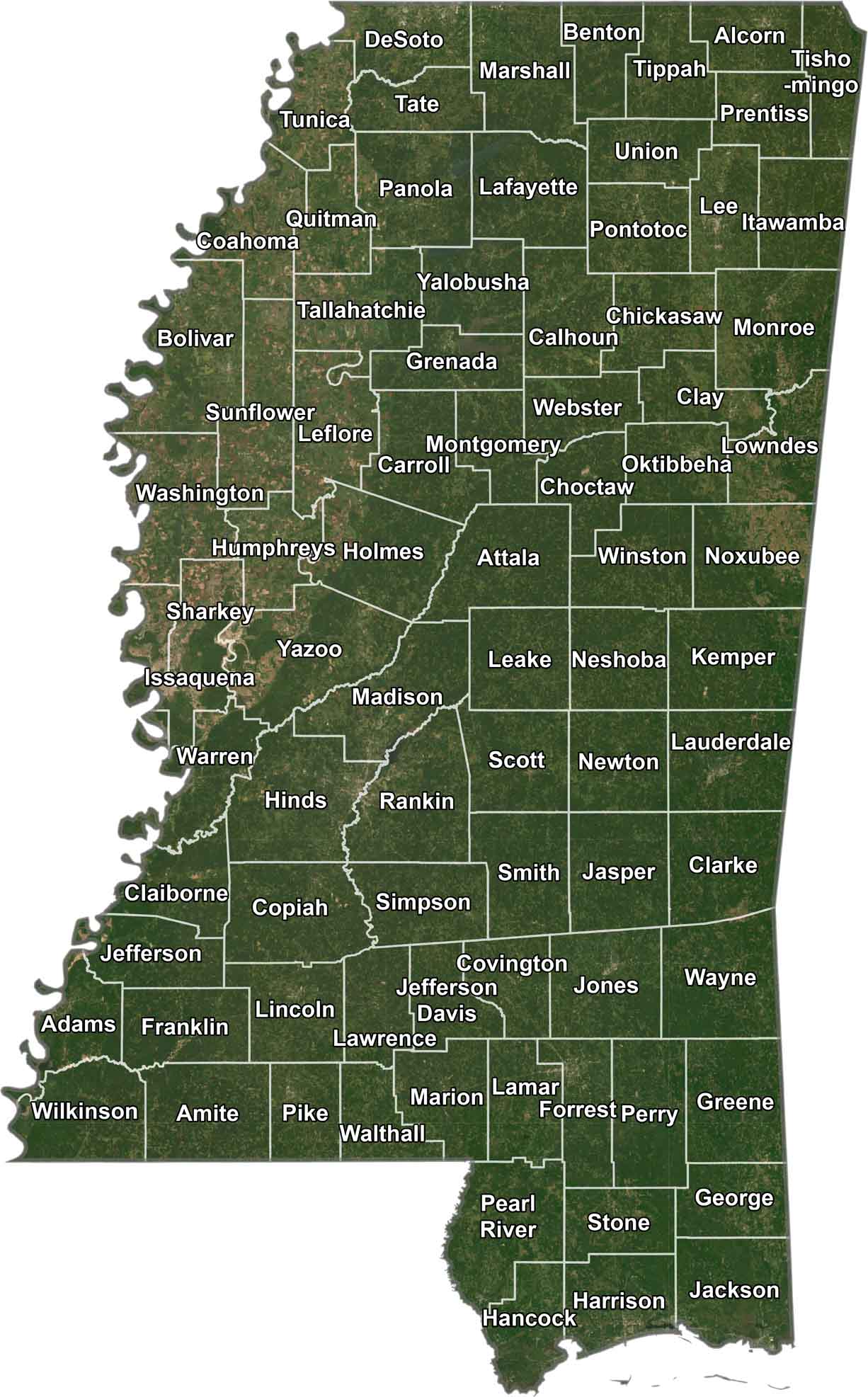
SATELLITE IMAGERY
Mississippi Satellite County Map
In our satellite map, Mississippi shows off a mix of farmland, forests, and winding rivers. Our satellite map keeps it real, with each county outlined so you can spot the borders without losing the landscape.
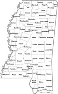
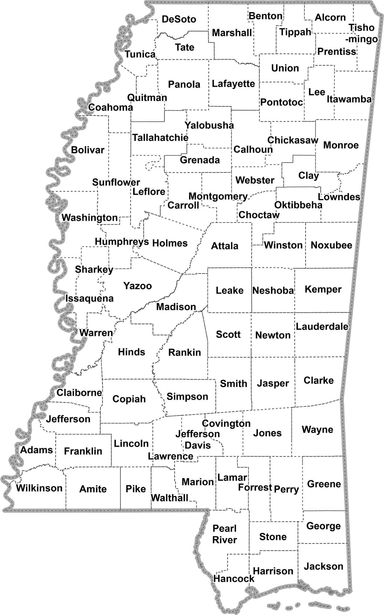
OUTLINE MAP
Mississippi Simple County Map
Mississippi, broken down nice and easy. Just counties, clearly labeled. It’s a clean layout to help you find your way around.
Mississippi Counties
In Mississippi, Hinds County is the most populated county. It’s home to Jackson, the state capital, which explains a lot. Now, if you’re looking for some real peace and quiet, Issaquena County is your spot. It’s the least populous county in Mississippi. Why? Well, it’s right in the middle of the Delta, mostly farmland.
Most Populous: Hinds County
Least Populous: Issaquena County

In terms of land area (excluding water), the biggest county by area is Yazoo County. It stretches from the edge of the Delta into the central hills, covering 923 square miles. The smallest? That’d be Alcorn County up in the northeast corner at 400 square miles.
Largest Area: Yazoo County
Smallest Area: Alcorn County
Mississippi’s counties have some interesting stories behind their names. For instance, Yalobusha County comes from a Choctaw phrase meaning “tadpole place.” Or how about Itawamba County? It’s named after a Chickasaw chief who was known as the “Bench Chief” (because he liked to sit on a bench). The state started setting up counties pretty early on. Adams County was established in 1799 when Mississippi was still a territory.
Mississippi County List
Our Mississippi county list displays important statistics for each one:
| FIPS Code | Name | Land % | Water % | Total Area (sq mi) |
|---|---|---|---|---|
| 28-001 | Adams County | 94.8 | 5.2 | 487.5 |
| 28-003 | Alcorn County | 99.7 | 0.3 | 401.4 |
| 28-005 | Amite County | 99.8 | 0.2 | 731.6 |
| 28-007 | Attala County | 99.8 | 0.2 | 736.7 |
| 28-009 | Benton County | 99.5 | 0.5 | 408.7 |
| 28-011 | Bolivar County | 96.8 | 3.2 | 905.8 |
| 28-013 | Calhoun County | 99.8 | 0.2 | 588.0 |
| 28-015 | Carroll County | 99.0 | 1.0 | 634.6 |
| 28-017 | Chickasaw County | 99.5 | 0.5 | 504.2 |
| 28-019 | Choctaw County | 99.6 | 0.4 | 419.9 |
| 28-021 | Claiborne County | 97.2 | 2.8 | 501.2 |
| 28-023 | Clarke County | 99.7 | 0.3 | 693.5 |
| 28-025 | Clay County | 98.6 | 1.4 | 416.0 |
| 28-027 | Coahoma County | 94.7 | 5.3 | 583.1 |
| 28-029 | Copiah County | 99.7 | 0.3 | 779.5 |
| 28-031 | Covington County | 99.7 | 0.3 | 414.9 |
| 28-033 | DeSoto County | 95.8 | 4.2 | 497.0 |
| 28-035 | Forrest County | 99.1 | 0.9 | 470.2 |
| 28-037 | Franklin County | 99.5 | 0.5 | 566.8 |
| 28-039 | George County | 99.0 | 1.0 | 483.7 |
| 28-041 | Greene County | 99.2 | 0.8 | 718.7 |
| 28-043 | Grenada County | 93.9 | 6.1 | 449.4 |
| 28-045 | Hancock County | 85.7 | 14.3 | 552.8 |
| 28-047 | Harrison County | 58.3 | 41.7 | 984.7 |
| 28-049 | Hinds County | 99.1 | 0.9 | 877.3 |
| 28-051 | Holmes County | 99.0 | 1.0 | 764.6 |
| 28-053 | Humphreys County | 97.1 | 2.9 | 431.2 |
| 28-055 | Issaquena County | 93.6 | 6.4 | 441.4 |
| 28-057 | Itawamba County | 98.6 | 1.4 | 540.4 |
| 28-059 | Jackson County | 69.3 | 30.7 | 1,043.4 |
| 28-061 | Jasper County | 99.8 | 0.2 | 677.5 |
| 28-063 | Jefferson County | 98.6 | 1.4 | 527.3 |
| 28-065 | Jefferson Davis County | 99.8 | 0.2 | 409.1 |
| 28-067 | Jones County | 99.3 | 0.7 | 699.7 |
| 28-069 | Kemper County | 99.9 | 0.1 | 767.0 |
| 28-071 | Lafayette County | 93.0 | 7.0 | 679.2 |
| 28-073 | Lamar County | 99.3 | 0.7 | 500.0 |
| 28-075 | Lauderdale County | 98.4 | 1.6 | 715.1 |
| 28-077 | Lawrence County | 98.8 | 1.2 | 435.8 |
| 28-079 | Leake County | 99.6 | 0.4 | 585.4 |
| 28-081 | Lee County | 99.3 | 0.7 | 453.2 |
| 28-083 | Leflore County | 98.0 | 2.0 | 606.4 |
| 28-085 | Lincoln County | 99.7 | 0.3 | 588.2 |
| 28-087 | Lowndes County | 97.9 | 2.1 | 516.5 |
| 28-089 | Madison County | 96.3 | 3.7 | 742.0 |
| 28-091 | Marion County | 98.9 | 1.1 | 548.6 |
| 28-093 | Marshall County | 99.5 | 0.5 | 709.7 |
| 28-095 | Monroe County | 99.1 | 0.9 | 772.1 |
| 28-097 | Montgomery County | 99.8 | 0.2 | 407.9 |
| 28-099 | Neshoba County | 99.7 | 0.3 | 571.6 |
| 28-101 | Newton County | 99.7 | 0.3 | 579.6 |
| 28-103 | Noxubee County | 99.3 | 0.7 | 700.0 |
| 28-105 | Oktibbeha County | 99.2 | 0.8 | 461.9 |
| 28-107 | Panola County | 97.2 | 2.8 | 705.1 |
| 28-109 | Pearl River County | 99.0 | 1.0 | 819.3 |
| 28-111 | Perry County | 99.5 | 0.5 | 650.2 |
| 28-113 | Pike County | 99.6 | 0.4 | 410.7 |
| 28-115 | Pontotoc County | 99.3 | 0.7 | 501.0 |
| 28-117 | Prentiss County | 99.2 | 0.8 | 418.2 |
| 28-119 | Quitman County | 99.7 | 0.3 | 406.4 |
| 28-121 | Rankin County | 96.2 | 3.8 | 806.1 |
| 28-123 | Scott County | 99.8 | 0.2 | 610.4 |
| 28-125 | Sharkey County | 99.2 | 0.8 | 435.1 |
| 28-127 | Simpson County | 99.8 | 0.2 | 590.5 |
| 28-129 | Smith County | 99.8 | 0.2 | 637.3 |
| 28-131 | Stone County | 99.4 | 0.6 | 448.1 |
| 28-133 | Sunflower County | 98.7 | 1.3 | 706.9 |
| 28-135 | Tallahatchie County | 98.9 | 1.1 | 652.1 |
| 28-137 | Tate County | 98.5 | 1.5 | 411.0 |
| 28-139 | Tippah County | 99.5 | 0.5 | 460.0 |
| 28-141 | Tishomingo County | 95.5 | 4.5 | 444.5 |
| 28-143 | Tunica County | 94.6 | 5.4 | 480.7 |
| 28-145 | Union County | 99.7 | 0.3 | 416.9 |
| 28-147 | Walthall County | 99.9 | 0.1 | 404.4 |
| 28-149 | Warren County | 95.1 | 4.9 | 618.6 |
| 28-151 | Washington County | 95.2 | 4.8 | 761.2 |
| 28-153 | Wayne County | 99.7 | 0.3 | 813.5 |
| 28-155 | Webster County | 99.5 | 0.5 | 423.2 |
| 28-157 | Wilkinson County | 98.6 | 1.4 | 687.8 |
| 28-159 | Winston County | 99.5 | 0.5 | 610.1 |
| 28-161 | Yalobusha County | 94.4 | 5.6 | 495.0 |
| 28-163 | Yazoo County | 98.7 | 1.3 | 934.2 |
Source: United States Census Bureau