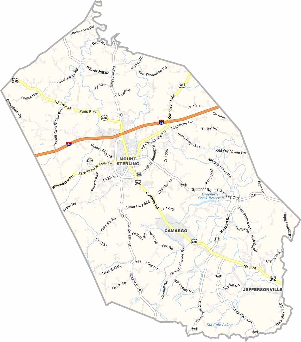
Montgomery County Map, Kentucky
We allow you to use our Montgomery County map. Attribution is required.
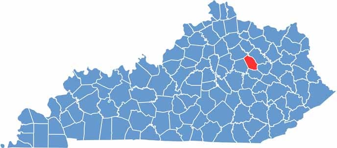
Montgomery County, Kentucky
Montgomery County is in eastern Kentucky, where the Bluegrass meets the mountains. The county is easily accessible via I-64 and US-460.
Mount Sterling, the county seat, hosts the Court Days Festival every October. Think of it like a giant yard sale and county fair. Plus, it’s one of the oldest and largest outdoor markets in Kentucky.
The county has some nice horse farms if you’re into fancy four-legged creatures. Approximately 28,000 call Montgomery County their home. Overall, it’s the rolling hills and horse farms that define the region.
| Category | Details |
|---|---|
| County Name | Montgomery County |
| County Seat | Mount Sterling |
| Population | Approximately 28,000 |
| Cities, Towns, and Communities | Mount Sterling, Jeffersonville, Camargo, Levee, Judy |
| Interstates and Highways | I-64, US-60, KY-11, KY-686 |
| FIPS Code | 21-173 |
| Total Area (Land and Water) | 199 sq mi (Land: 198 sq mi; Water: 1 sq mi) |
| Adjacent Counties (and Direction) | Bourbon County (Northwest), Bath County (Northeast), Menifee County (Southeast), Powell County (South), Clark County (West) |
| Time Zone | Eastern Time Zone (ET) |
| State | Kentucky |
| Coordinates | 38.0567° N, 83.8898° W |
| Etymology | Named after Richard Montgomery, a Revolutionary War general |
| Major Landmarks | Gateway Regional Arts Center, Montgomery County Courthouse, Judy Watermill |
Kentucky County Maps
Get to know all the counties in Kentucky with our map collection.


