Utah County Map

Utah County Map Collection

We allow you to use our Utah County map. Attribution is required.
Utah County Maps
Utah is divided into 29 counties with a pretty wild landscape. Check out our county maps of Utah below.


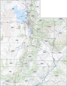
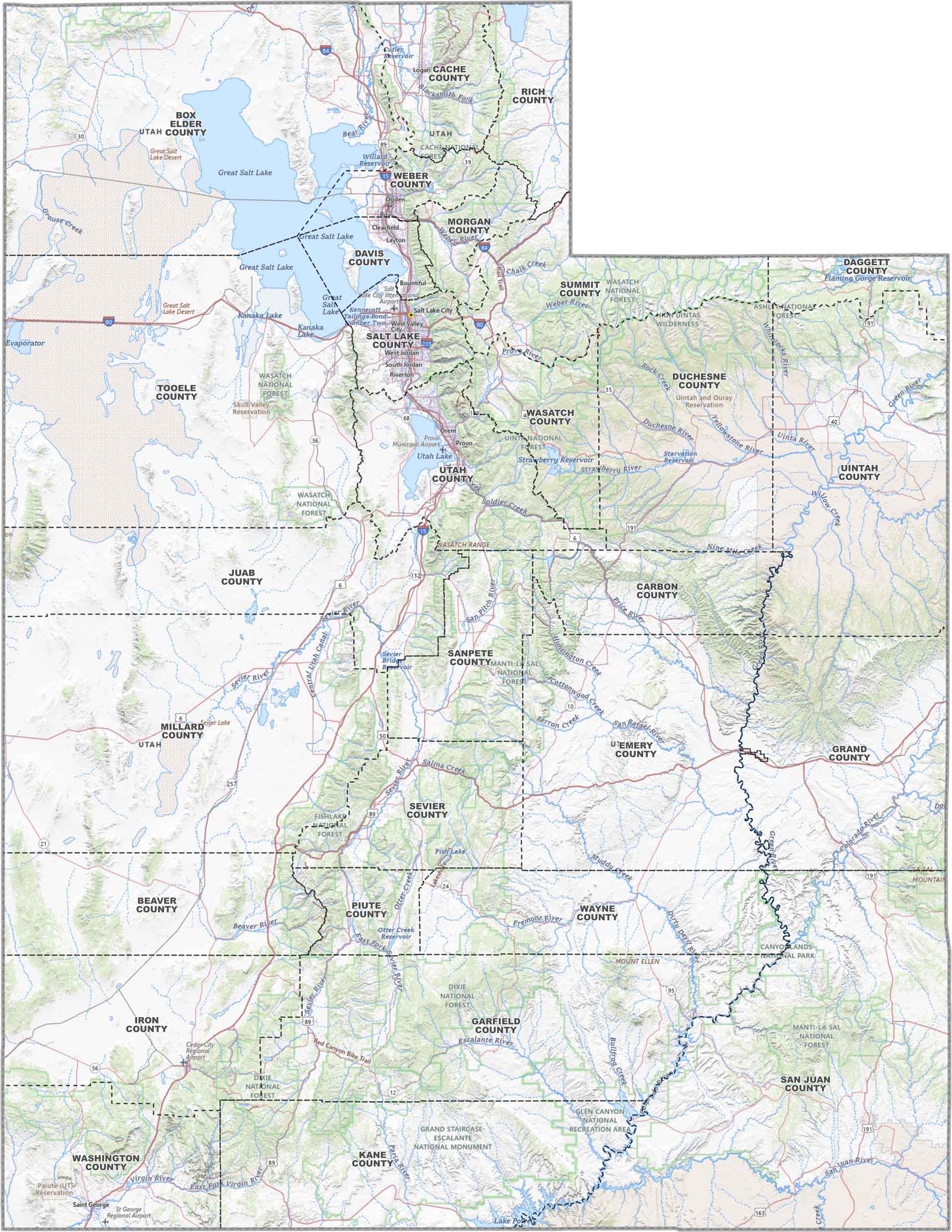
PHYSICAL MAP
Utah Topographic County Map
This map’s got Utah covered. You’ll see county lines drawn out across the desert and mountains. There’s also highways stretching from Salt Lake to St. George. It’s all here, ready to explore.
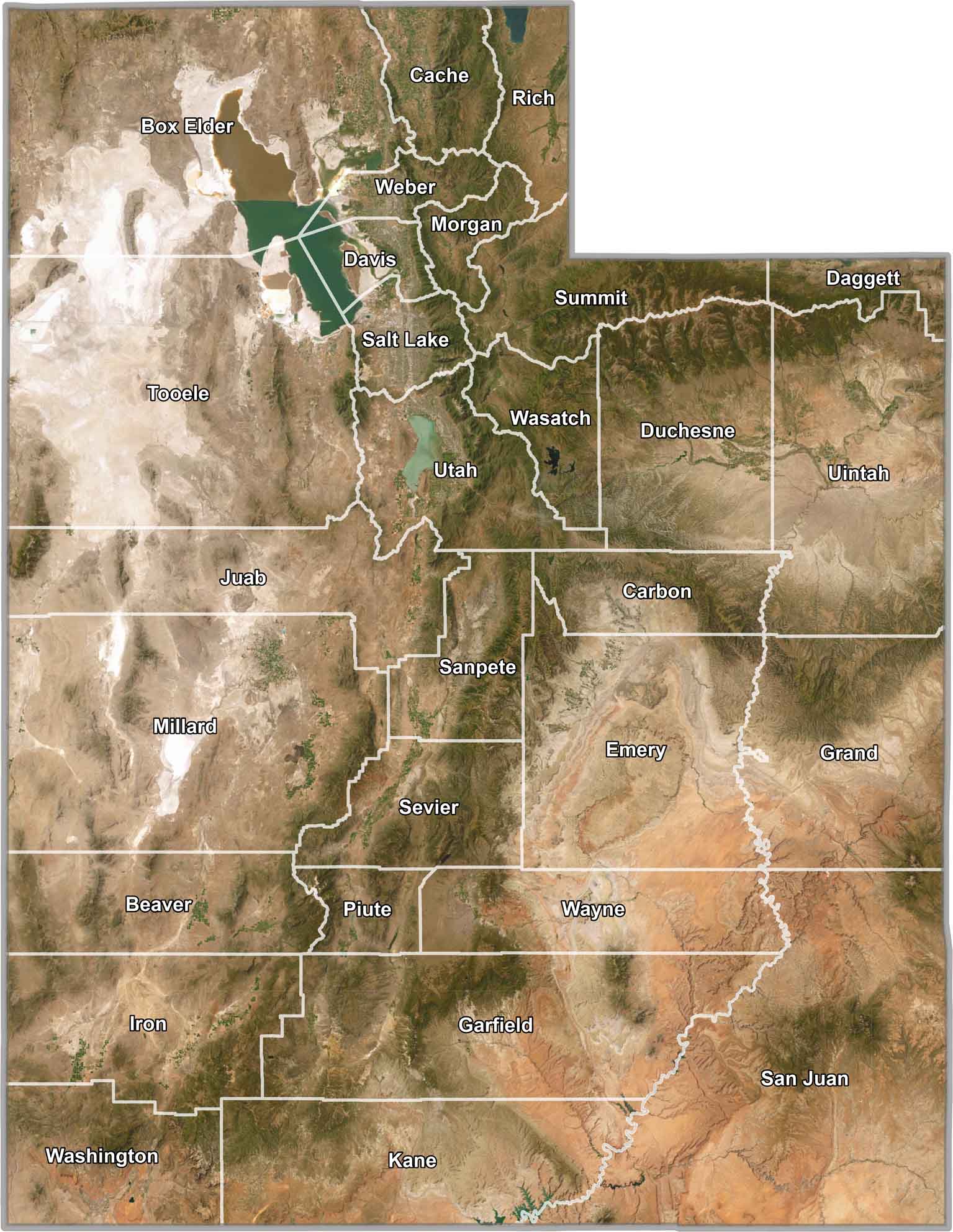
SATELLITE IMAGERY
Utah Satellite County Map
From above, Utah’s a wild mix. You’ll see rocky reds, salt flats, deep green forests, and of course the Great Salt Lake. County borders are on top of it all.
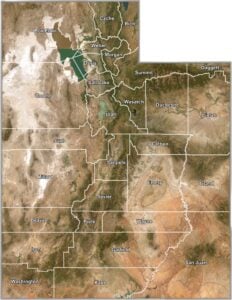
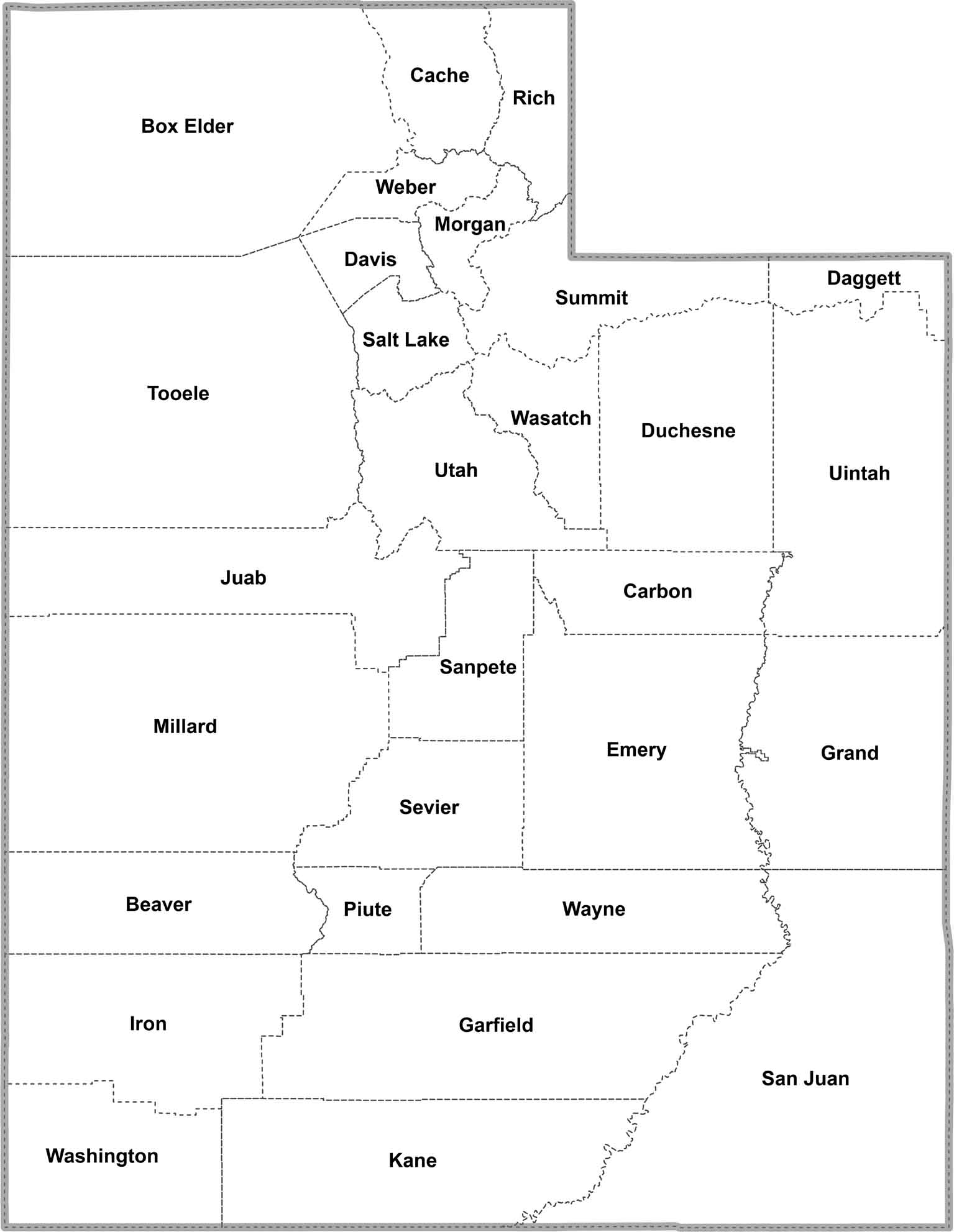
OUTLINE MAP
Utah Simple County Map
Just the bones. Utah, divided by county. Clear, clean, and easy to scan. Look at how the state’s mapped out below.
Utah Counties
Counties come in various sizes. Salt Lake County is the most populous county in Utah. It’s home to Salt Lake City, the state capital and biggest city. More than a third of Utah’s people live there. On the flip side, there’s Daggett County, which is mostly mountains and forests.
Most Populous: Salt Lake County
Least Populous: Daggett County

San Juan County is the biggest county, covering over 7,800 square miles. It’s mostly desert, with places like Monument Valley and part of Canyonlands National Park.
The smallest county is Davis County, just north of Salt Lake City. It’s only about 300 square miles, but it’s packed with people and has a nice stretch of the Great Salt Lake shoreline.
Largest Area: San Juan County
Smallest Area: Davis County
Utah’s counties have some unique perspectives. For example, Piute County got its name from the Native American tribe. There’s also Grand County, which split off from Emery County in 1890 because folks were tired of riding so far to get to the courthouse.
Utah County List
Here’s a table with statistics and all of the counties in Utah:
| FIPS Code | Name | Land % | Water % | Total Area (sq mi) |
|---|---|---|---|---|
| 49-001 | Beaver County | 99.9 | 0.1 | 2,584.9 |
| 49-003 | Box Elder County | 85.4 | 14.6 | 6,729.2 |
| 49-005 | Cache County | 99.3 | 0.7 | 1,172.9 |
| 49-007 | Carbon County | 99.6 | 0.4 | 1,485.3 |
| 49-009 | Daggett County | 96.7 | 3.3 | 720.6 |
| 49-011 | Davis County | 47.1 | 52.9 | 635.2 |
| 49-013 | Duchesne County | 99.5 | 0.5 | 3,250.3 |
| 49-015 | Emery County | 99.8 | 0.2 | 4,471.8 |
| 49-017 | Garfield County | 99.4 | 0.6 | 5,208.2 |
| 49-019 | Grand County | 99.7 | 0.3 | 3,684.9 |
| 49-021 | Iron County | 99.9 | 0.1 | 3,300.7 |
| 49-023 | Juab County | 99.6 | 0.4 | 3,405.8 |
| 49-025 | Kane County | 97.1 | 2.9 | 4,108.1 |
| 49-027 | Millard County | 96.6 | 3.4 | 6,836.9 |
| 49-029 | Morgan County | 99.7 | 0.3 | 610.9 |
| 49-031 | Piute County | 99.0 | 1.0 | 766.3 |
| 49-033 | Rich County | 94.7 | 5.3 | 1,086.4 |
| 49-035 | Salt Lake County | 92.1 | 7.9 | 805.7 |
| 49-037 | San Juan County | 98.6 | 1.4 | 7,933.2 |
| 49-039 | Sanpete County | 99.2 | 0.8 | 1,602.3 |
| 49-041 | Sevier County | 99.6 | 0.4 | 1,918.2 |
| 49-043 | Summit County | 99.5 | 0.5 | 1,880.8 |
| 49-045 | Tooele County | 95.3 | 4.7 | 7,286.0 |
| 49-047 | Uintah County | 99.5 | 0.5 | 4,504.0 |
| 49-049 | Utah County | 93.4 | 6.6 | 2,144.2 |
| 49-051 | Wasatch County | 97.5 | 2.5 | 1,207.6 |
| 49-053 | Washington County | 99.9 | 0.1 | 2,430.4 |
| 49-055 | Wayne County | 99.8 | 0.2 | 2,466.8 |
| 49-057 | Weber County | 87.3 | 12.7 | 659.8 |
Source: United States Census Bureau