Garfield County Map, Colorado
We allow you to use our Garfield County map. Attribution is required.
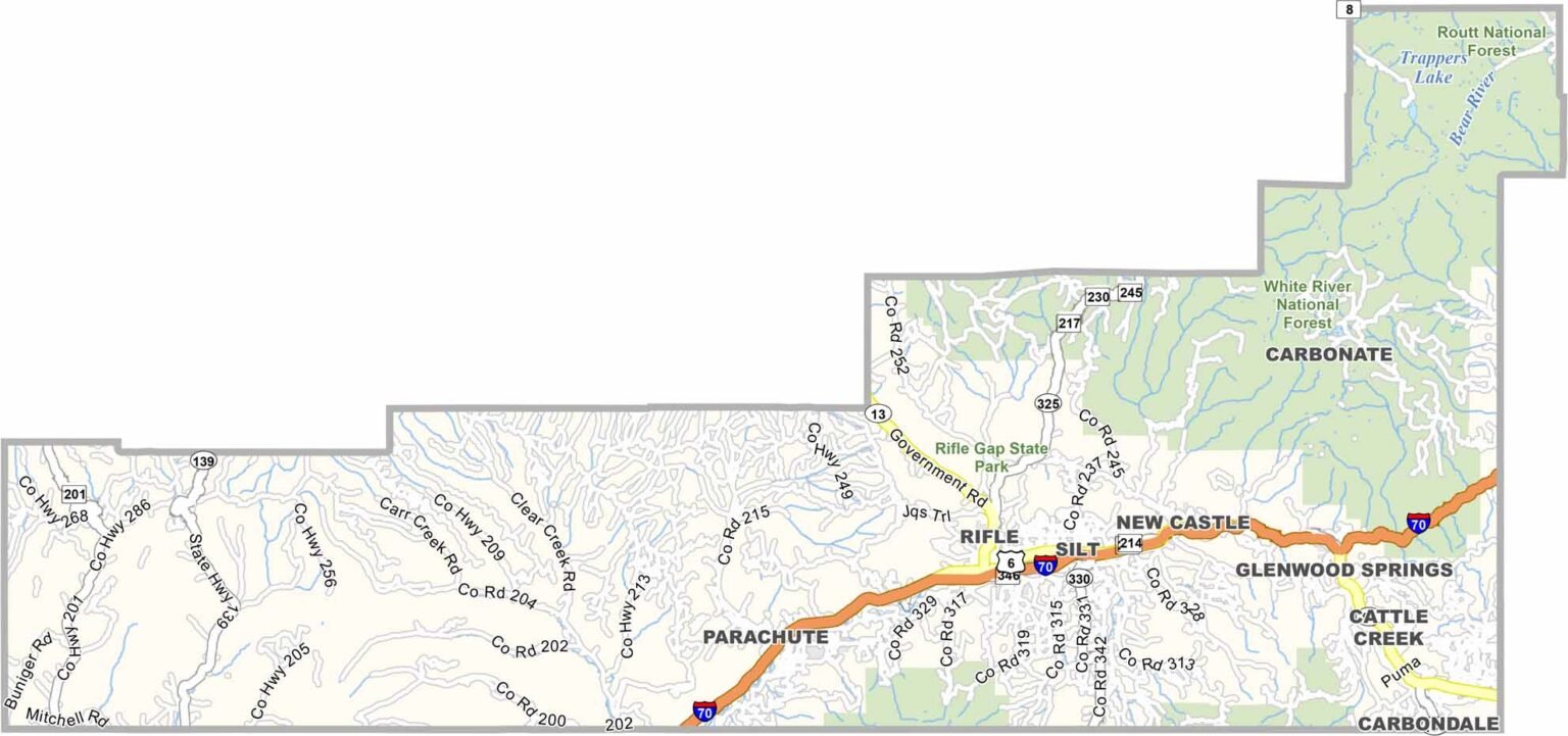
Garfield County, Colorado

Garfield County stretches across western Colorado, from high mountains to desert canyons. Glenwood Springs is the county seat, famous for its hot springs. Rifle and Carbondale are other key towns.
There’s a mix of industries here. Tourism, ranching, and natural gas drilling. The Colorado River runs through, cutting impressive canyons. This means outdoor recreation is huge, from skiing to hiking to rafting.
The county has seen ups and downs with energy booms and busts. You’ve got everything from high-end resorts to working-class towns. The population is growing, now around 62,000. Despite changes, there’s still a strong sense of the Old West here.
| Category | Details |
|---|---|
| County Name | Garfield County |
| County Seat | Glenwood Springs |
| Population | 62,000 |
| Cities, Towns, and Communities | Glenwood Springs, Rifle, Carbondale, New Castle, Silt |
| Interstates and Highways | I-70, US 6, State Highway 82, State Highway 13 |
| FIPS Code | 08-045 |
| Total Area | 2,964 sq mi (land), 1 sq mi (water) |
| Adjacent Counties | Rio Blanco County (North), Routt County (Northeast), Eagle County (East), Pitkin County (Southeast), Mesa County (South), Grand County, Utah (Southwest), Uintah County, Utah (Northwest) |
| Time Zone | Mountain Time Zone (MT) |
| State | Colorado |
| Coordinates | 39.55° N, 107.32° W |
| Etymology | Named in honor of President James A. Garfield, the twentieth President of the United States |
| Major Landmarks | Glenwood Hot Springs, Hanging Lake, Rifle Falls State Park |
| Website | Garfield County Website |
Colorado County Maps
Get to know all the counties in Colorado with our map collection.


