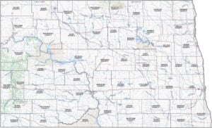
North Dakota County Map

North Dakota County Map Collection

We allow you to use our North Dakota County map. Attribution is required.
North Dakota County Maps
North Dakota may not be the largest state, but it has a surprising number of counties within its borders. It has 53 counties, to be exact. Click on any one of them for more information.


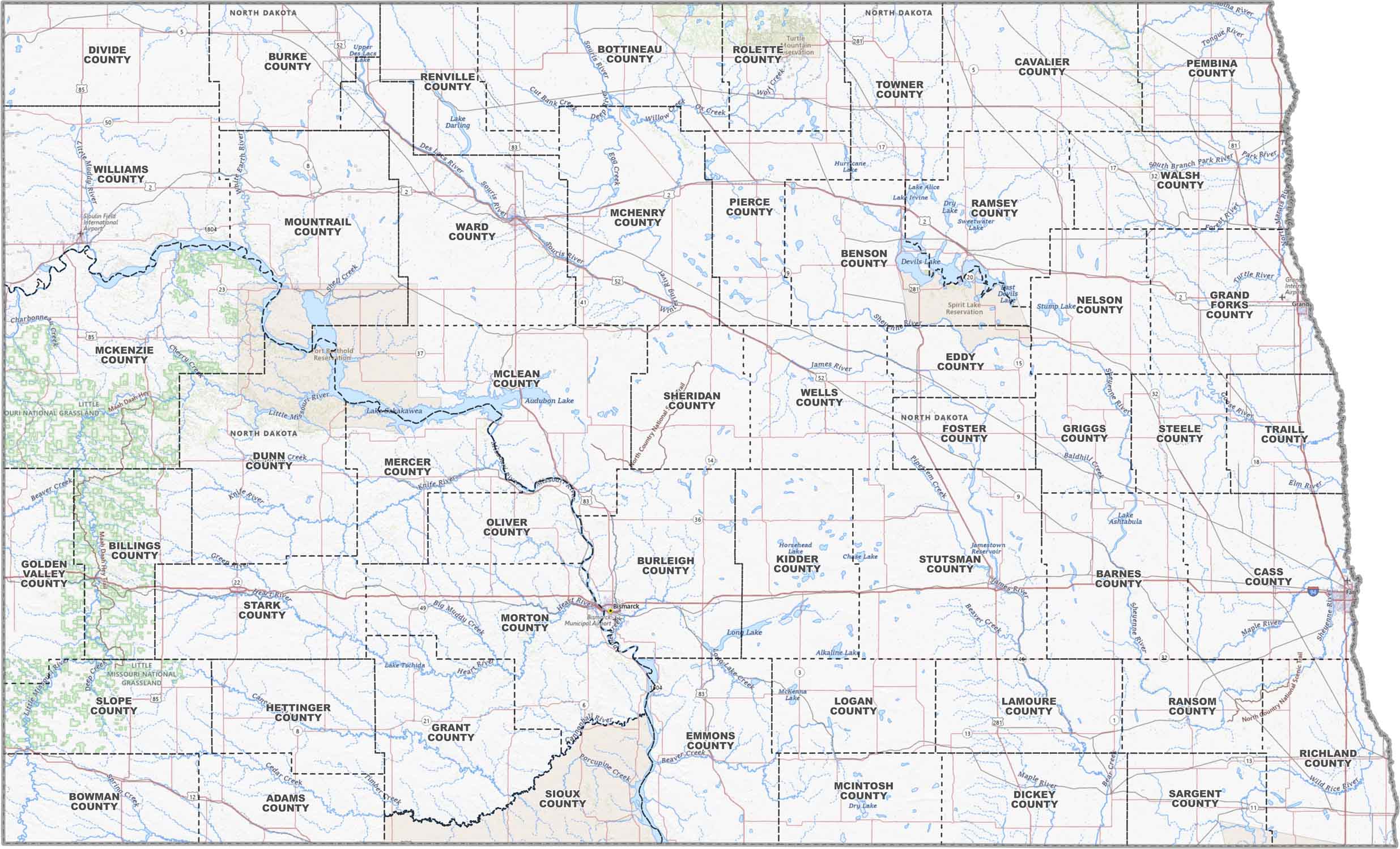
PHYSICAL MAP
North Dakota Topographic County Map
Our topographic map gives you new look at North Dakota with counties outlined and highways running across the plains. Cities and towns are also labeled so you can get a sense of the state’s layout.
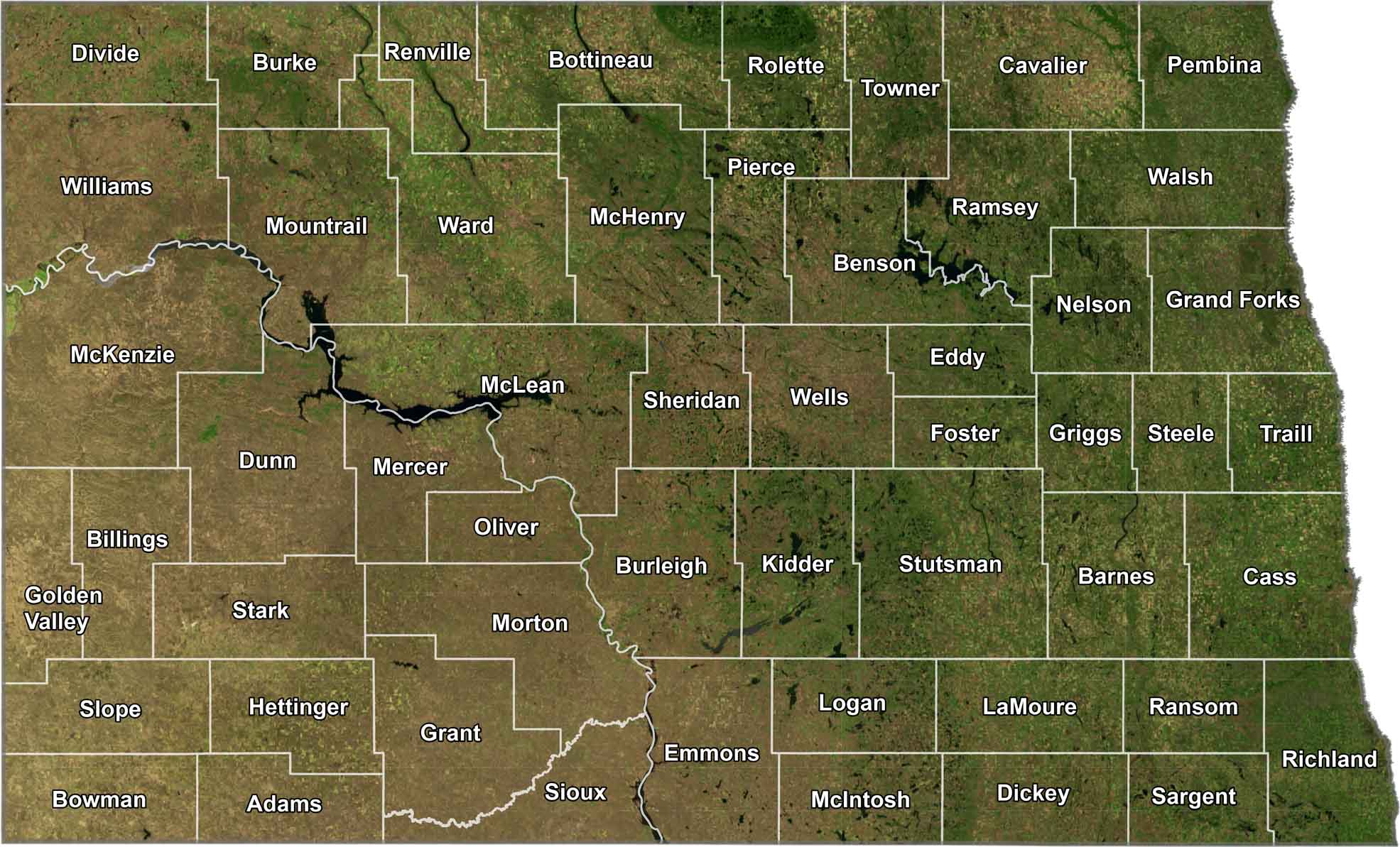
SATELLITE IMAGERY
North Dakota Satellite County Map
As you can see below, North Dakota is all fields, rivers, and wide-open land. Although it might be difficult to see, towns are spaced way out. But county borders are drawn in so you can see where everything falls.
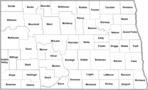
OUTLINE MAP
North Dakota Simple County Map
This is just a clear, no-frills map of North Dakota by county. It’s labeled and easy to read, perfect for a quick black and white printout.

North Dakota Counties
Cass County stands out as the most populous. The reason mainly is because it’s home to Fargo, North Dakota’s largest city. On the other end of the spectrum, Slope County is the least populous. With fewer than 800 residents, it’s where the prairie still feels endless.
Most Populous: Cass County
Least Populous: Slope County

In terms of size, McKenzie County is the largest, covering over 2,700 square miles. Located in the heart of the Bakken oil fields, it has experienced significant growth. The smallest county, Eddy County, spans just over 600 square miles.
Largest Area: McKenzie County
Smallest Area: Eddy County
North Dakota’s counties often have names that reflect the state’s early history. For instance, Burleigh County is named after Walter A. Burleigh, a politician and early settler of the state.
North Dakota County List
Here’s a complete list of North Dakota’s counties:
| FIPS Code | Name | Land % | Water % | Total Area (sq mi) |
|---|---|---|---|---|
| 38-001 | Adams County | 99.9 | 0.1 | 988.7 |
| 38-003 | Barnes County | 98.6 | 1.4 | 1,513.4 |
| 38-005 | Benson County | 96.5 | 3.5 | 1,439.5 |
| 38-007 | Billings County | 99.6 | 0.4 | 1,153.5 |
| 38-009 | Bottineau County | 98.3 | 1.7 | 1,697.3 |
| 38-011 | Bowman County | 99.6 | 0.4 | 1,167.1 |
| 38-013 | Burke County | 97.8 | 2.2 | 1,128.9 |
| 38-015 | Burleigh County | 97.9 | 2.1 | 1,668.3 |
| 38-017 | Cass County | 99.8 | 0.2 | 1,767.9 |
| 38-019 | Cavalier County | 98.6 | 1.4 | 1,510.0 |
| 38-021 | Dickey County | 99.1 | 0.9 | 1,142.1 |
| 38-023 | Divide County | 97.4 | 2.6 | 1,294.2 |
| 38-025 | Dunn County | 96.5 | 3.5 | 2,082.0 |
| 38-027 | Eddy County | 97.8 | 2.2 | 644.1 |
| 38-029 | Emmons County | 97.1 | 2.9 | 1,555.0 |
| 38-031 | Foster County | 98.2 | 1.8 | 646.8 |
| 38-033 | Golden Valley County | 99.8 | 0.2 | 1,003.1 |
| 38-035 | Grand Forks County | 99.8 | 0.2 | 1,439.5 |
| 38-037 | Grant County | 99.6 | 0.4 | 1,665.9 |
| 38-039 | Griggs County | 98.9 | 1.1 | 716.4 |
| 38-041 | Hettinger County | 99.9 | 0.1 | 1,133.8 |
| 38-043 | Kidder County | 94.3 | 5.7 | 1,432.9 |
| 38-045 | LaMoure County | 99.6 | 0.4 | 1,150.9 |
| 38-047 | Logan County | 98.2 | 1.8 | 1,011.2 |
| 38-049 | McHenry County | 98.0 | 2.0 | 1,911.6 |
| 38-051 | McIntosh County | 98.0 | 2.0 | 994.7 |
| 38-053 | McKenzie County | 96.5 | 3.5 | 2,860.9 |
| 38-055 | McLean County | 90.6 | 9.4 | 2,328.0 |
| 38-057 | Mercer County | 93.7 | 6.3 | 1,112.5 |
| 38-059 | Morton County | 99.0 | 1.0 | 1,945.4 |
| 38-061 | Mountrail County | 94.0 | 6.0 | 1,941.5 |
| 38-063 | Nelson County | 97.3 | 2.7 | 1,008.8 |
| 38-065 | Oliver County | 98.8 | 1.2 | 731.2 |
| 38-067 | Pembina County | 99.8 | 0.2 | 1,121.4 |
| 38-069 | Pierce County | 94.1 | 5.9 | 1,082.3 |
| 38-071 | Ramsey County | 91.2 | 8.8 | 1,300.9 |
| 38-073 | Ransom County | 99.8 | 0.2 | 863.7 |
| 38-075 | Renville County | 98.2 | 1.8 | 892.7 |
| 38-077 | Richland County | 99.3 | 0.7 | 1,445.4 |
| 38-079 | Rolette County | 96.1 | 3.9 | 939.3 |
| 38-081 | Sargent County | 99.0 | 1.0 | 866.9 |
| 38-083 | Sheridan County | 96.7 | 3.3 | 1,005.6 |
| 38-085 | Sioux County | 97.0 | 3.0 | 1,128.2 |
| 38-087 | Slope County | 99.7 | 0.3 | 1,219.1 |
| 38-089 | Stark County | 99.6 | 0.4 | 1,340.2 |
| 38-091 | Steele County | 99.5 | 0.5 | 715.5 |
| 38-093 | Stutsman County | 96.7 | 3.3 | 2,297.9 |
| 38-095 | Towner County | 98.4 | 1.6 | 1,041.5 |
| 38-097 | Traill County | 99.9 | 0.1 | 862.5 |
| 38-099 | Walsh County | 99.0 | 1.0 | 1,294.1 |
| 38-101 | Ward County | 97.9 | 2.1 | 2,055.9 |
| 38-103 | Wells County | 98.5 | 1.5 | 1,290.4 |
| 38-105 | Williams County | 96.7 | 3.3 | 2,148.1 |
Source: United States Census Bureau