Wyoming County Map

Wyoming County Map Collection
We allow you to use our Wyoming County map. Attribution is required.
Wyoming County Maps
Wyoming is split into 23 counties. What I can say about Wyoming is that the landscape is diverse. See it all below.


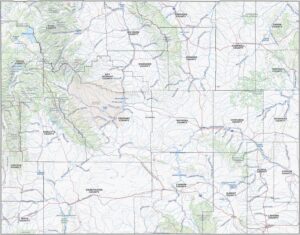
PHYSICAL MAP
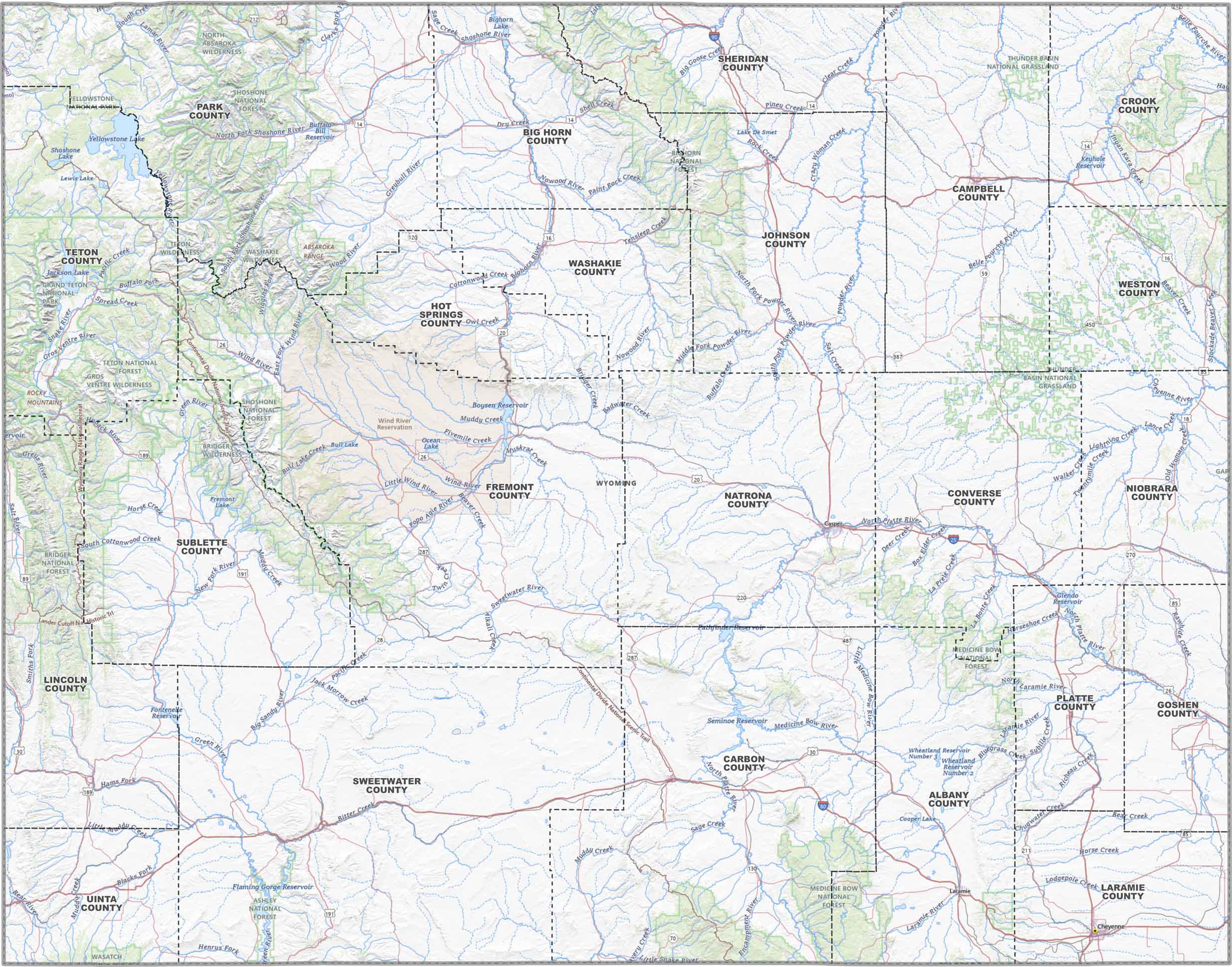
Wyoming Topographic County Map
Wyoming’s big on space, but this map pulls it all together… You’ll find county outlines, major highways, city markers, winding rivers, and scattered lakes. It’s the full layout for a state that doesn’t mess around.
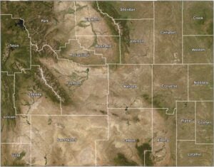
SATELLITE IMAGERY
Wyoming Satellite County Map
Wyoming is all raw land. Out satellite map shows off its mountains, plains, plateaus, and just enough towns to remind you people live here. The best part? County lines show you how the state is divided.

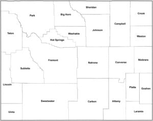
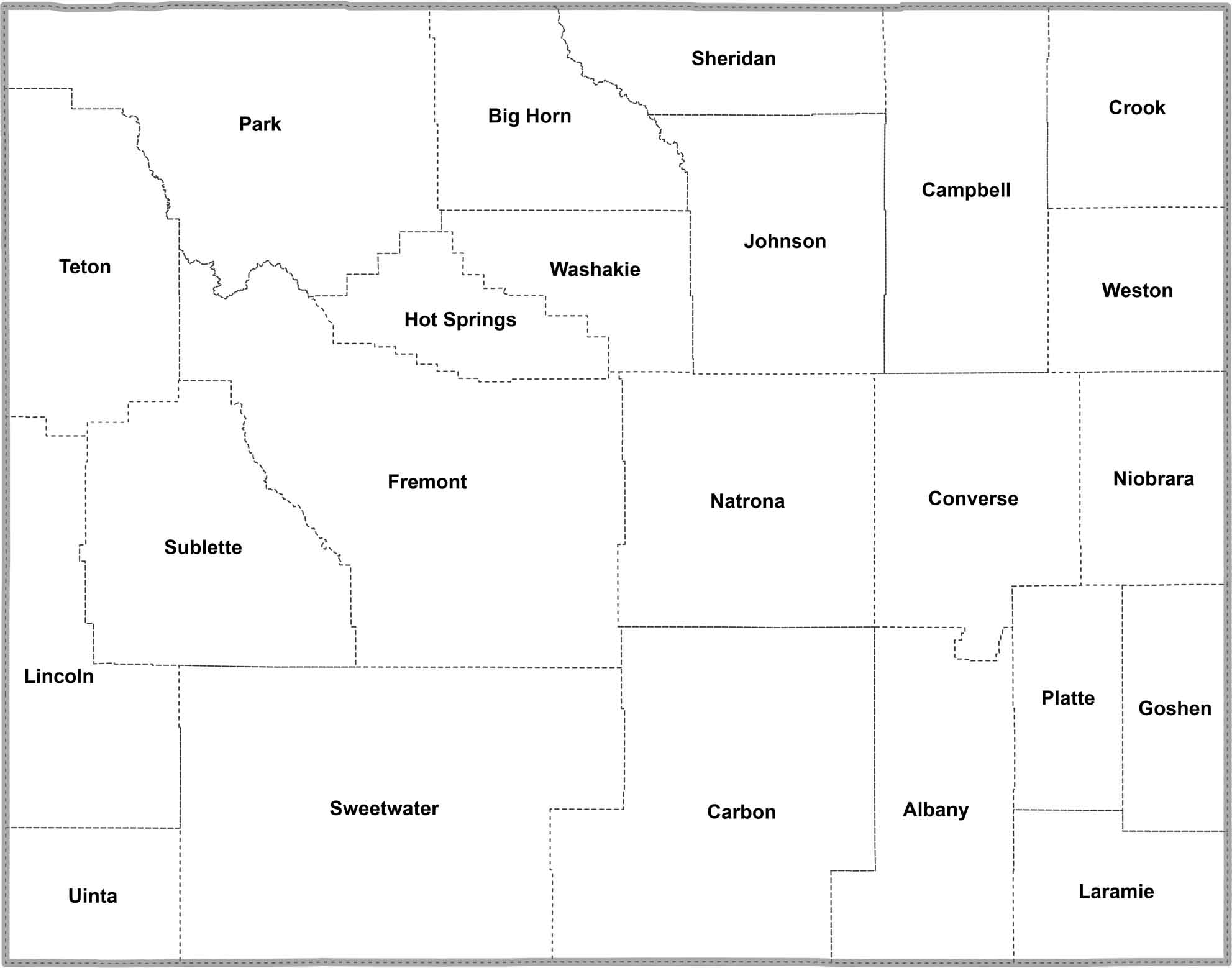
OUTLINE MAP
Wyoming Simple County Map
Straightforward and clean. Wyoming’s county lines are all you’ll see here, labeled and laid out without extras. Just the basics, for when you want structure.
Wyoming Counties
Wyoming has mountains in the west, high plains in the east, and places like Yellowstone and the Grand Tetons thrown in for good measure. You’ll notice that each county has its own mix of these features.

In terms of population, Laramie County is the most populous county. It’s home to Cheyenne, the state capital and largest city. On the other hand, Niobrara County is least populous. It’s out in the eastern plains, mostly ranches and wide-open spaces. In fact, it has fewer than 2,500 people.
Most Populous: Laramie County
Least Populous: Niobrara County
Sweetwater County is the biggest county, covering over 10,000 square miles. That’s bigger than some of the smaller states in the U.S. The smallest county is Hot Springs County, but it’s still over 2,000 square miles. It has some, you guessed it, hot springs, and a whole lot of empty space.
Largest Area: Sweetwater County
Smallest Area: Hot Springs County
The oldest county, Laramie, was set up back in 1867 when Wyoming was still just a territory. There’s also some interesting tidbits to each one. Teton County got its name from the mountains range. Campbell County became the energy capital of the state thanks to its coal mines.
Wyoming County List
The table below shows statistics for counties in Wyoming.
| FIPS Code | Name | Land % | Water % | Total Area (sq mi) |
|---|---|---|---|---|
| 56-001 | Albany County | 99.2 | 0.8 | 4,308.7 |
| 56-003 | Big Horn County | 99.3 | 0.7 | 3,158.3 |
| 56-005 | Campbell County | 99.9 | 0.1 | 4,806.3 |
| 56-007 | Carbon County | 99.2 | 0.8 | 7,963.9 |
| 56-009 | Converse County | 99.8 | 0.2 | 4,265.0 |
| 56-011 | Crook County | 99.6 | 0.4 | 2,865.3 |
| 56-013 | Fremont County | 99.1 | 0.9 | 9,265.7 |
| 56-015 | Goshen County | 99.7 | 0.3 | 2,232.2 |
| 56-017 | Hot Springs County | 99.9 | 0.1 | 2,006.4 |
| 56-019 | Johnson County | 99.5 | 0.5 | 4,174.6 |
| 56-021 | Laramie County | 99.9 | 0.1 | 2,687.5 |
| 56-023 | Lincoln County | 99.5 | 0.5 | 4,094.6 |
| 56-025 | Natrona County | 99.3 | 0.7 | 5,375.6 |
| 56-027 | Niobrara County | 99.9 | 0.1 | 2,627.9 |
| 56-029 | Park County | 99.6 | 0.4 | 6,965.1 |
| 56-031 | Platte County | 98.6 | 1.4 | 2,110.8 |
| 56-033 | Sheridan County | 99.9 | 0.1 | 2,526.4 |
| 56-035 | Sublette County | 99.0 | 1.0 | 4,935.6 |
| 56-037 | Sweetwater County | 99.4 | 0.6 | 10,491.1 |
| 56-039 | Teton County | 94.8 | 5.2 | 4,217.2 |
| 56-041 | Uinta County | 99.7 | 0.3 | 2,088.1 |
| 56-043 | Washakie County | 99.8 | 0.2 | 2,242.7 |
| 56-045 | Weston County | 99.9 | 0.1 | 2,400.0 |
Source: United States Census Bureau