Oregon County Map

Oregon County Map Collection
We allow you to use our Oregon County map. Attribution is required.
Oregon County Maps
Oregon is home to 36 counties. Click on one of our maps below to get a sneak peak at what it’s all about.


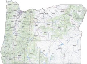
PHYSICAL MAP
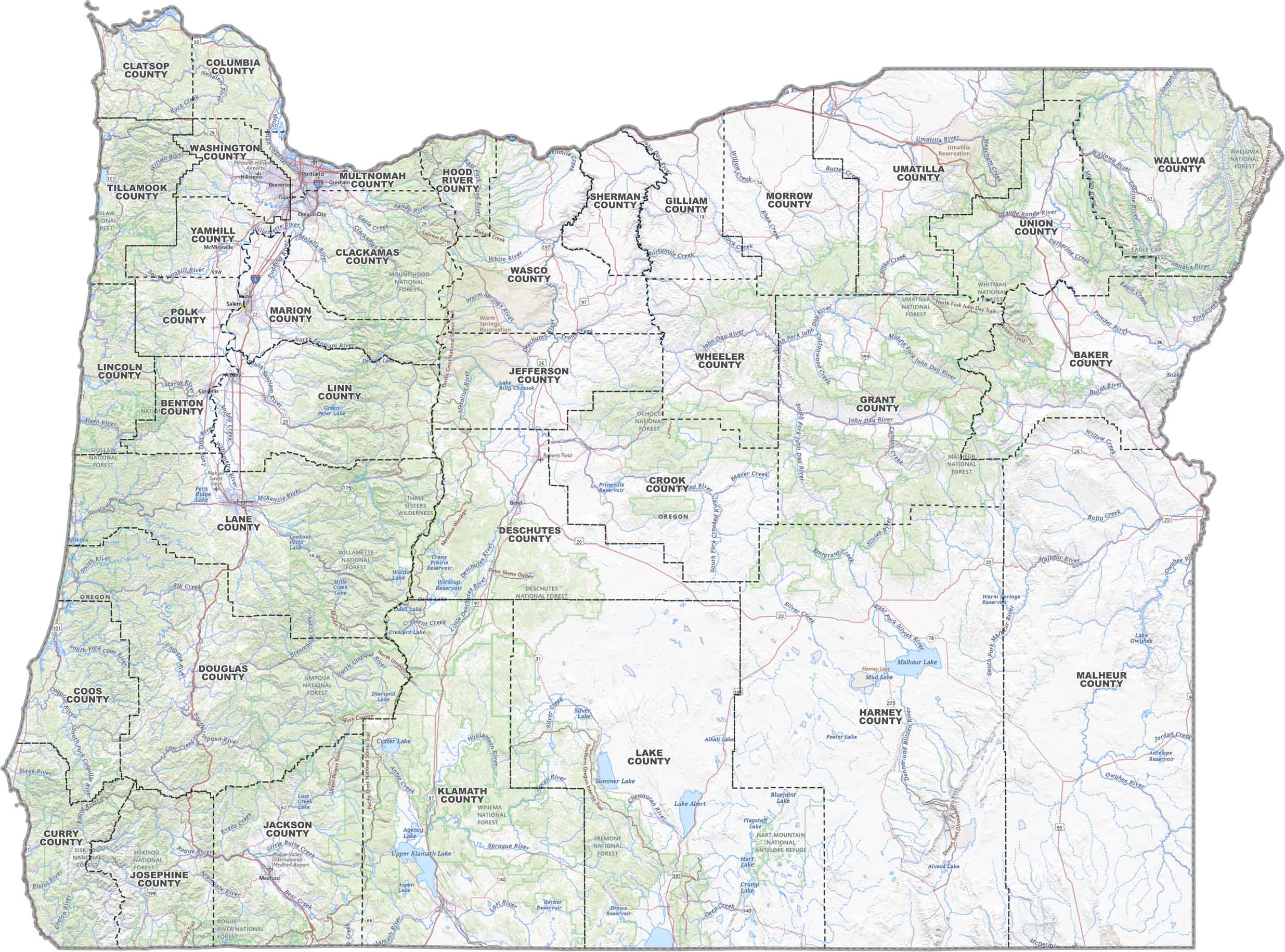
Oregon Topographic County Map
Oregon’s all mapped out here. Counties are outlined. Major highways like I-5 are easy to follow. Cities, rivers, and lakes (yes, even Crater Lake) are clearly marked. Heading to the coast or deep into the Cascades with this topographic map.
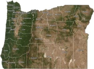
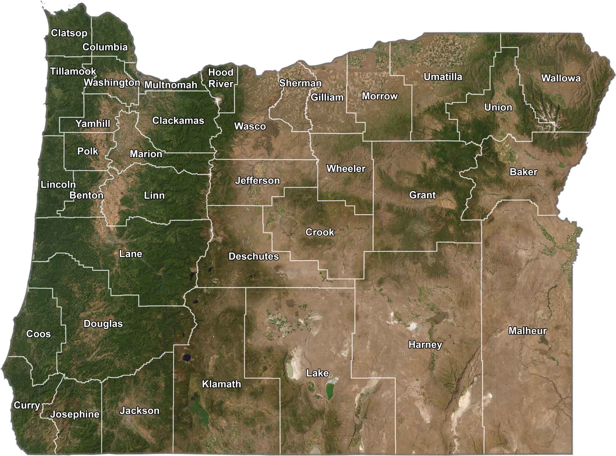
SATELLITE IMAGERY
Oregon Satellite County Map
Oregon has dense forests in the west, high desert in the east, mountains cutting through the middle. Our satellite map shows off county lines with the view of Oregon from space.
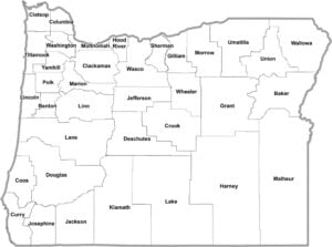
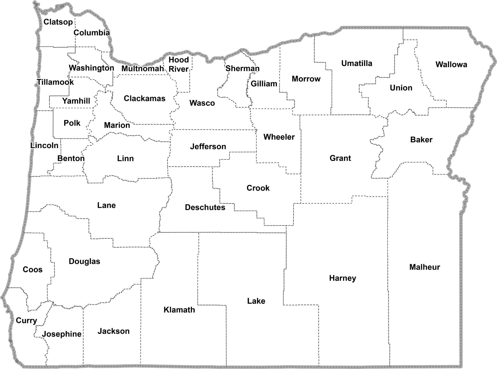
OUTLINE MAP
Oregon Simple County Map
This is just Oregon, county by county. Clean lines, easy labels, no distractions. A quick way to see how the state’s divided from border to border.
Oregon Counties
For population, Multnomah County is the highest. No surprise there, since it’s home to Portland, Oregon’s largest city. It’s a world apart from Wheeler County, the state’s least populated. Tucked away in the central part of the state, Wheeler’s mostly ranch land and fossil beds.
Most Populous: Multnomah County
Least Populous: Wheeler County

In terms of area, Harney County is the largest, sprawling over 10,000 square miles. That’s a lot of space spanning from mostly high desert to rangeland. You could fit a small country in there and still have room left over.
Largest Area: Harney County
Smallest Area: Multnomah County
On the flip side of area, there’s Multnomah County again. It’s the smallest in size at just 431 square miles, excluding water as area. But it packs in over 800,000 people. It goes to show size isn’t everything when it comes to counties.
Many Oregon counties are named after Native American tribes or significant historical figures. As an example, Clackamas County is named after the Clackamas Indians who used to live there. Then there’s Lane County, who’s named after Joseph Lane, Oregon’s first territorial governor.
Oregon County List
We’ve listed out Oregon counties below with areas and FIPS codes:
| FIPS Code | Name | Land % | Water % | Total Area (sq mi) |
|---|---|---|---|---|
| 41-001 | Baker County | 99.4 | 0.6 | 3,088.0 |
| 41-003 | Benton County | 99.6 | 0.4 | 678.2 |
| 41-005 | Clackamas County | 99.3 | 0.7 | 1,883.0 |
| 41-007 | Clatsop County | 76.4 | 23.6 | 1,083.6 |
| 41-009 | Columbia County | 95.5 | 4.5 | 689.0 |
| 41-011 | Coos County | 88.4 | 11.6 | 1,806.3 |
| 41-013 | Crook County | 99.7 | 0.3 | 2,987.0 |
| 41-015 | Curry County | 81.9 | 18.1 | 1,989.2 |
| 41-017 | Deschutes County | 98.8 | 1.2 | 3,054.2 |
| 41-019 | Douglas County | 98.1 | 1.9 | 5,132.9 |
| 41-021 | Gilliam County | 98.5 | 1.5 | 1,222.8 |
| 41-023 | Grant County | 100.0 | 0.0 | 4,528.5 |
| 41-025 | Harney County | 99.1 | 0.9 | 10,227.7 |
| 41-027 | Hood River County | 97.9 | 2.1 | 533.3 |
| 41-029 | Jackson County | 99.4 | 0.6 | 2,801.3 |
| 41-031 | Jefferson County | 99.4 | 0.6 | 1,792.3 |
| 41-033 | Josephine County | 99.9 | 0.1 | 1,640.8 |
| 41-035 | Klamath County | 96.8 | 3.2 | 6,137.2 |
| 41-037 | Lake County | 97.4 | 2.6 | 8,358.1 |
| 41-039 | Lane County | 96.4 | 3.6 | 4,724.5 |
| 41-041 | Lincoln County | 82.1 | 17.9 | 1,194.5 |
| 41-043 | Linn County | 99.2 | 0.8 | 2,306.6 |
| 41-045 | Malheur County | 99.6 | 0.4 | 9,929.7 |
| 41-047 | Marion County | 99.1 | 0.9 | 1,190.8 |
| 41-049 | Morrow County | 99.2 | 0.8 | 2,047.7 |
| 41-051 | Multnomah County | 92.7 | 7.3 | 465.2 |
| 41-053 | Polk County | 99.6 | 0.4 | 744.1 |
| 41-055 | Sherman County | 99.1 | 0.9 | 831.2 |
| 41-057 | Tillamook County | 82.7 | 17.3 | 1,332.4 |
| 41-059 | Umatilla County | 99.5 | 0.5 | 3,231.5 |
| 41-061 | Union County | 99.9 | 0.1 | 2,038.8 |
| 41-063 | Wallowa County | 99.8 | 0.2 | 3,151.4 |
| 41-065 | Wasco County | 99.4 | 0.6 | 2,394.9 |
| 41-067 | Washington County | 99.7 | 0.3 | 726.6 |
| 41-069 | Wheeler County | 100.0 | 0.0 | 1,716.5 |
| 41-071 | Yamhill County | 99.7 | 0.3 | 718.4 |
Source: United States Census Bureau