West Virginia County Map

West Virginia County Map Collection

We allow you to use our West Virginia County map. Attribution is required.
West Virginia County Maps
The Mountain State is carved up into 55 counties. Here is a map of each county of West Virginia.


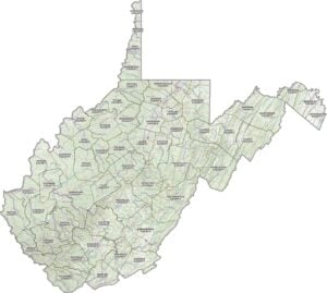
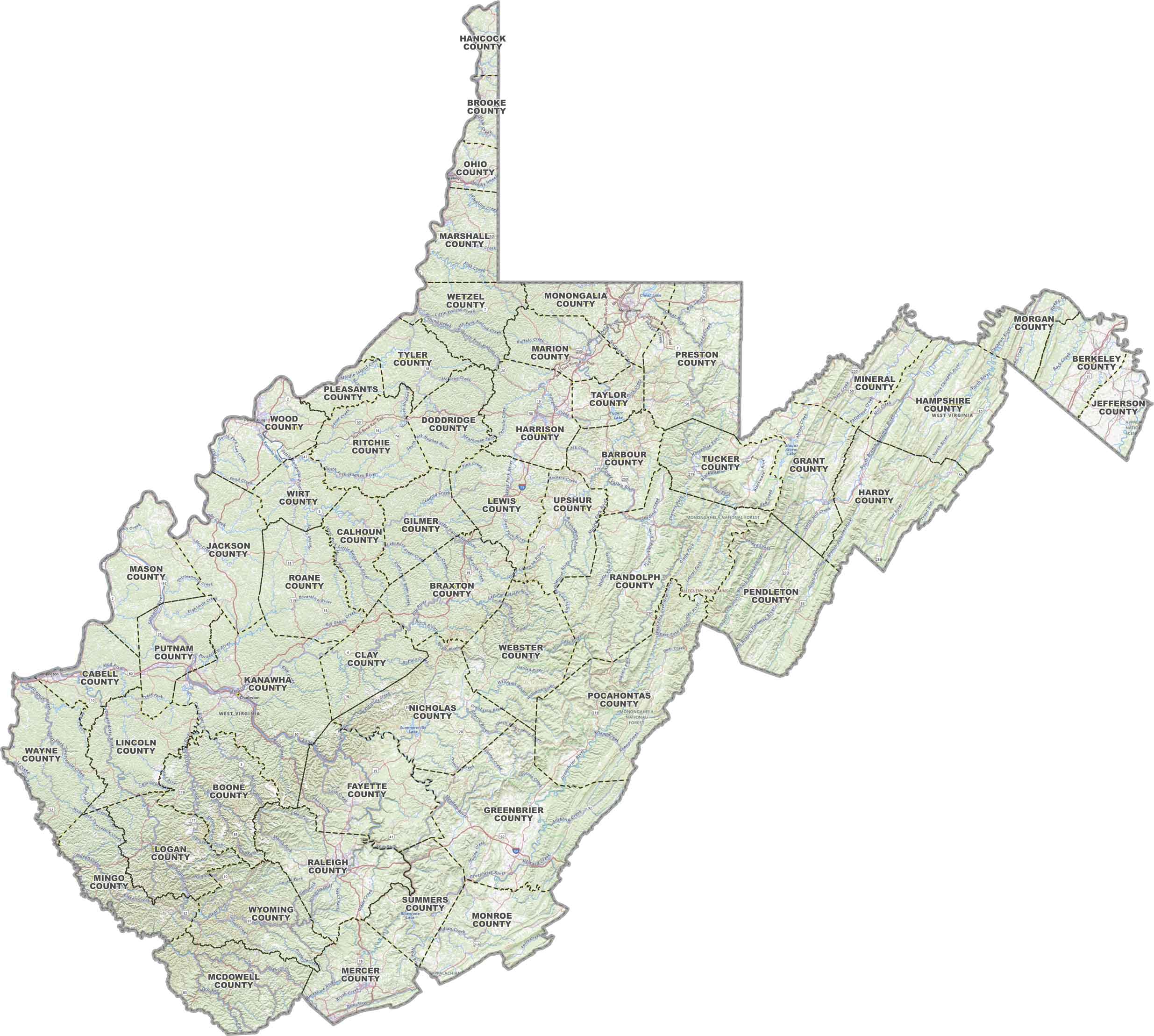
PHYSICAL MAP
West Virginia Topographic County Map
Looking to make sense of West Virginia’s twists and turns. This map’s got you covered with county borders, major highways and a whole lot more.
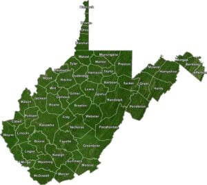
SATELLITE IMAGERY
West Virginia Satellite County Map
West Virginia from above is all ridges, rivers, and forest. Our satellite map shows off its natural texture with county lines drawn in.

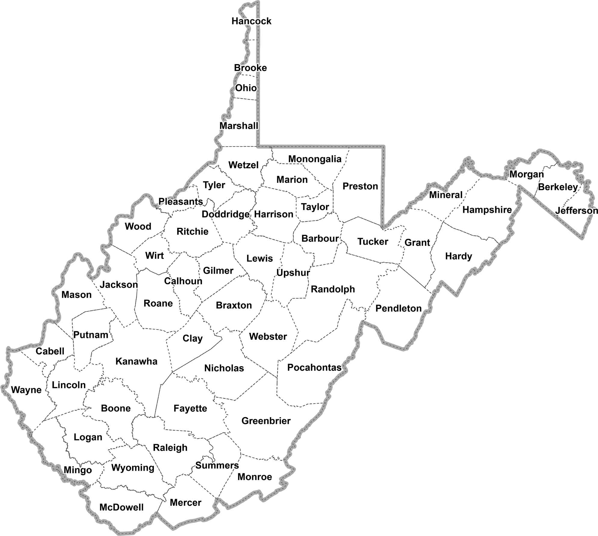
OUTLINE MAP
West Virginia Simple County Map
Here’s West Virginia in its simplest form. Its counties are clearly marked without any extra layers. This is just a straightforward view of how the Mountain State is carved up.
West Virginia Counties
The whole state of West Virginia is pretty hilly. And well, they don’t call it the Mountain State for nothing. You’ve got the Appalachians running through it, with valleys, forests, and rivers all over the place.

In terms of people, Kanawha County is the most populous county in the state. It’s home to Charleston, the state capital and largest city. Otherwise, there’s Wirt County with lowest population. This county tucked away in the west, mostly rural with rolling hills and farmland.
Most Populous: Kanawha County
Least Populous: Wirt County
Randolph County is the largest county, covering about 1,040 square miles. It has a big chunk of the Monongahela National Forest, so there’s plenty of room for hiking and camping. The smallest county is Hancock County, way up in the northern panhandle. It’s only about 83 square miles, but it makes up for it with some Ohio River frontage.
Largest Area: Randolph County
Smallest Area: Hancock County
West Virginia’s counties are pretty unique. Berkeley County is older than the state itself. It actually was part of Virginia until West Virginia split off during the Civil War. The newest county, Mingo County, was only created in 1895.
West Virginia County List
Here’s a complete list of West Virginia’s counties:
| FIPS Code | Name | Land % | Water % | Total Area (sq mi) |
|---|---|---|---|---|
| 54-001 | Barbour County | 99.5 | 0.5 | 342.8 |
| 54-003 | Berkeley County | 99.9 | 0.1 | 321.6 |
| 54-005 | Boone County | 99.7 | 0.3 | 503.2 |
| 54-007 | Braxton County | 98.9 | 1.1 | 516.3 |
| 54-009 | Brooke County | 96.4 | 3.6 | 92.6 |
| 54-011 | Cabell County | 97.6 | 2.4 | 288.0 |
| 54-013 | Calhoun County | 99.5 | 0.5 | 280.7 |
| 54-015 | Clay County | 99.5 | 0.5 | 343.8 |
| 54-017 | Doddridge County | 99.8 | 0.2 | 320.5 |
| 54-019 | Fayette County | 99.0 | 1.0 | 668.3 |
| 54-021 | Gilmer County | 99.5 | 0.5 | 340.1 |
| 54-023 | Grant County | 99.4 | 0.6 | 480.3 |
| 54-025 | Greenbrier County | 99.5 | 0.5 | 1,024.5 |
| 54-027 | Hampshire County | 99.3 | 0.7 | 644.6 |
| 54-029 | Hancock County | 93.9 | 6.1 | 88.0 |
| 54-031 | Hardy County | 99.6 | 0.4 | 584.5 |
| 54-033 | Harrison County | 99.9 | 0.1 | 416.5 |
| 54-035 | Jackson County | 98.5 | 1.5 | 471.6 |
| 54-037 | Jefferson County | 98.9 | 1.1 | 211.7 |
| 54-039 | Kanawha County | 99.0 | 1.0 | 910.9 |
| 54-041 | Lewis County | 99.3 | 0.7 | 389.6 |
| 54-043 | Lincoln County | 99.6 | 0.4 | 438.6 |
| 54-045 | Logan County | 99.6 | 0.4 | 455.6 |
| 54-047 | McDowell County | 99.7 | 0.3 | 534.9 |
| 54-049 | Marion County | 99.1 | 0.9 | 311.5 |
| 54-051 | Marshall County | 97.8 | 2.2 | 312.2 |
| 54-053 | Mason County | 96.9 | 3.1 | 444.7 |
| 54-055 | Mercer County | 99.6 | 0.4 | 420.7 |
| 54-057 | Mineral County | 99.6 | 0.4 | 329.2 |
| 54-059 | Mingo County | 99.8 | 0.2 | 424.0 |
| 54-061 | Monongalia County | 98.4 | 1.6 | 365.9 |
| 54-063 | Monroe County | 99.8 | 0.2 | 473.6 |
| 54-065 | Morgan County | 99.8 | 0.2 | 229.6 |
| 54-067 | Nicholas County | 98.8 | 1.2 | 654.4 |
| 54-069 | Ohio County | 97.1 | 2.9 | 109.0 |
| 54-071 | Pendleton County | 99.7 | 0.3 | 698.1 |
| 54-073 | Pleasants County | 96.7 | 3.3 | 134.5 |
| 54-075 | Pocahontas County | 99.8 | 0.2 | 941.8 |
| 54-077 | Preston County | 99.6 | 0.4 | 651.4 |
| 54-079 | Putnam County | 98.7 | 1.3 | 350.4 |
| 54-081 | Raleigh County | 99.3 | 0.7 | 609.3 |
| 54-083 | Randolph County | 100.0 | 0.0 | 1,040.0 |
| 54-085 | Ritchie County | 99.6 | 0.4 | 453.7 |
| 54-087 | Roane County | 100.0 | 0.0 | 483.7 |
| 54-089 | Summers County | 98.1 | 1.9 | 367.7 |
| 54-091 | Taylor County | 98.3 | 1.7 | 175.7 |
| 54-093 | Tucker County | 99.5 | 0.5 | 421.1 |
| 54-095 | Tyler County | 98.3 | 1.7 | 260.7 |
| 54-097 | Upshur County | 100.0 | 0.0 | 354.8 |
| 54-099 | Wayne County | 98.8 | 1.2 | 512.1 |
| 54-101 | Webster County | 99.5 | 0.5 | 556.2 |
| 54-103 | Wetzel County | 99.1 | 0.9 | 361.3 |
| 54-105 | Wirt County | 99.0 | 1.0 | 234.8 |
| 54-107 | Wood County | 97.3 | 2.7 | 376.8 |
| 54-109 | Wyoming County | 99.5 | 0.5 | 501.8 |
Source: United States Census Bureau