Alaska Borough Map

Alaska Borough Map Collection


We allow you to use our Alaska Borough map. Attribution is required.
Alaska Borough Maps
Alaska’s county system is a whole different ballgame compared to the Lower 48. Instead of counties, it’s divided into 19 boroughs and 11 census areas (as shown below).


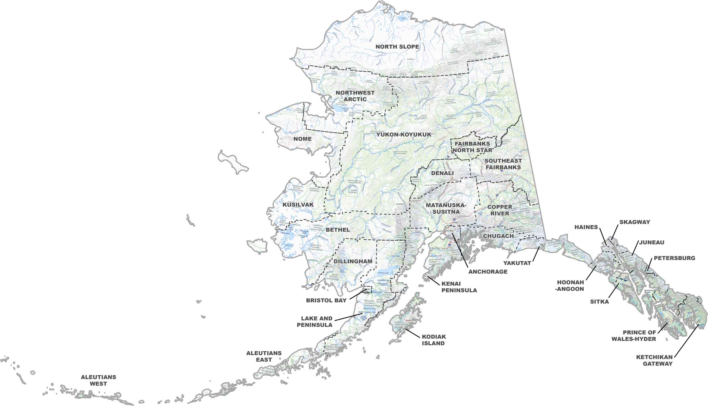
PHYSICAL MAP
Alaska Topographic Borough Map
Our Alaska’s topographic map overlays its boroughs, from east to west. Mountain ranges, glaciers, and river valleys shape each borough’s rugged terrain. Zoom in for yourself below.
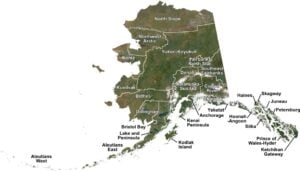
SATELLITE IMAGERY
Alaska Satellite Borough Map
Our satellite map of Alaska shows the boroughs in detail. You’ll see everything from snowy peaks to deep forests and icy coastlines. It’s Alaska as seen from space.

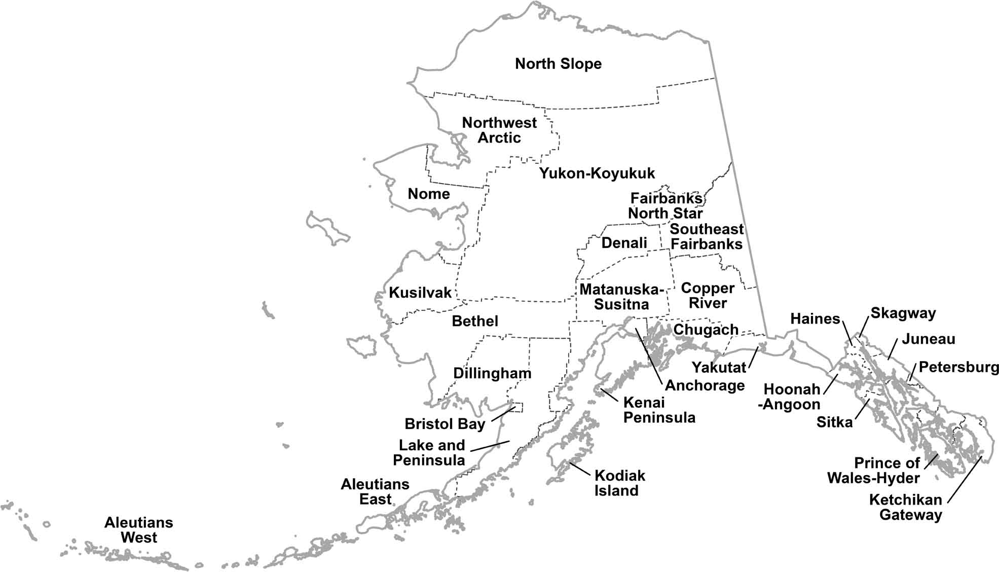
OUTLINE MAP
Alaska Simple Borough Map
This simple map outlines each of Alaska’s boroughs with its borders and labels. It’s easy to read and perfect for getting a sense of where everything is. Download it below.
Alaska Boroughs
As I mentioned before, Alaska has 19 organized boroughs and 11 census areas. There is another type of boundary in Alaska called an “Unorganized Borough”. This is basically government-speak for “figure it out yourselves.” The Unorganized Borough are those areas that are not contained in any of its 19 organized boroughs.
The Municipality of Anchorage takes the cake as the most populous borough. No surprise there as it’s home to Alaska’s biggest city, where nearly half the state’s population lives. Imagine that: almost one in every two Alaskans crowded into this one area. On the flip side, we’ve got the Yakutat City and Borough. It has fewer than 700 folks spread over an area the size of Delaware. Talk about breathing room.
Most Populous: Municipality of Anchorage
Least Populous: Yakutat City and Borough

For size, these boroughs make Lower 48 counties look like postage stamps. The North Slope Borough is a monster, covering over 94,000 square miles. That’s bigger than the entire state of Minnesota. It stretches from the Brooks Range to the Arctic Ocean. The tiniest borough? Skagway, a narrow strip of land nestled in the Inside Passage. But what it lacks in size, it makes up for in history as a gateway to the Klondike Gold Rush.
Largest Area: North Slope Borough
Smallest Area: Skagway Municipality
The borough system in Alaska is pretty young, all things considered. It only came into being in 1961, when the state constitution called for maximum local self-government. Before that? It was pretty much the Wild West in terms of local organization. The first organized borough, Bristol Bay, didn’t pop up until 1962. It’s a system born out of necessity and practicality in a state with vast distances and sparse population.
Whether you’re in the fishing villages of the Aleutians or the oil fields of the North Slope, these boroughs are the backdrop to Alaska’s wild and wonderful story. Living in these places isn’t for the faint of heart. In some boroughs, you’re more likely to run into a moose than your neighbor. And forget popping over to the next borough for a cup of sugar because in Alaska, that might mean flying an airplane.
Alaska Borough List
Here’s a full list of Alaska’s boroughs with quick facts about each one.
| FIPS Code | Name | Land % | Water % | Total Area (sq mi) |
|---|---|---|---|---|
| 02-013 | Aleutians East Borough | 46.5 | 53.5 | 15,016.0 |
| 02-016 | Aleutians West Census Area | 31.1 | 68.9 | 14,116.4 |
| 02-020 | Anchorage Municipality | 87.8 | 12.2 | 1,944.0 |
| 02-050 | Bethel Census Area | 89.2 | 10.8 | 45,558.8 |
| 02-060 | Bristol Bay Borough | 56.8 | 43.2 | 848.7 |
| 02-068 | Denali Borough | 99.8 | 0.2 | 12,662.4 |
| 02-070 | Dillingham Census Area | 88.9 | 11.1 | 20,628.8 |
| 02-090 | Fairbanks North Star Borough | 98.6 | 1.4 | 7,434.9 |
| 02-100 | Haines Borough | 85.2 | 14.8 | 2,745.4 |
| 02-105 | Hoonah-Angoon Census Area | 68.5 | 31.5 | 9,568.7 |
| 02-110 | Juneau City and Borough | 83.1 | 16.9 | 3,254.7 |
| 02-122 | Kenai Peninsula Borough | 64.8 | 35.2 | 24,720.3 |
| 02-130 | Ketchikan Gateway Borough | 73.0 | 27.0 | 6,652.9 |
| 02-150 | Kodiak Island Borough | 54.7 | 45.3 | 12,085.1 |
| 02-158 | Kusilvak Census Area | 86.9 | 13.1 | 19,658.5 |
| 02-164 | Lake and Peninsula Borough | 70.4 | 29.6 | 33,932.9 |
| 02-170 | Matanuska-Susitna Borough | 97.8 | 2.2 | 25,276.1 |
| 02-180 | Nome Census Area | 81.2 | 18.8 | 28,290.1 |
| 02-185 | North Slope Borough | 93.7 | 6.3 | 94,827.4 |
| 02-188 | Northwest Arctic Borough | 87.8 | 12.2 | 40,619.6 |
| 02-195 | Petersburg Borough | 75.9 | 24.1 | 3,821.8 |
| 02-198 | Prince of Wales-Hyder Census Area | 48.2 | 51.8 | 10,909.5 |
| 02-220 | Sitka City and Borough | 59.6 | 40.4 | 4,815.1 |
| 02-230 | Skagway Municipality | 97.5 | 2.5 | 445.0 |
| 02-240 | Southeast Fairbanks Census Area | 98.8 | 1.2 | 25,113.0 |
| 02-261 | Valdez-Cordova Census Area | 84.9 | 15.1 | 40,305.3 |
| 02-275 | Wrangell City and Borough | 73.5 | 26.5 | 3,476.6 |
| 02-282 | Yakutat City and Borough | 83.2 | 16.8 | 9,162.3 |
| 02-290 | Yukon-Koyukuk Census Area | 98.4 | 1.6 | 147,870.2 |
Source: United States Census Bureau