California County Map

California County Map Collection

We allow you to use our California County map. Attribution is required.
California County Maps
California is a whole different animal when it comes to counties. This state has 58 of ’em, and they’re about as diverse as you can get. I’d expect more than 58 counties, given its size and population. But Californians can be modest folks too.


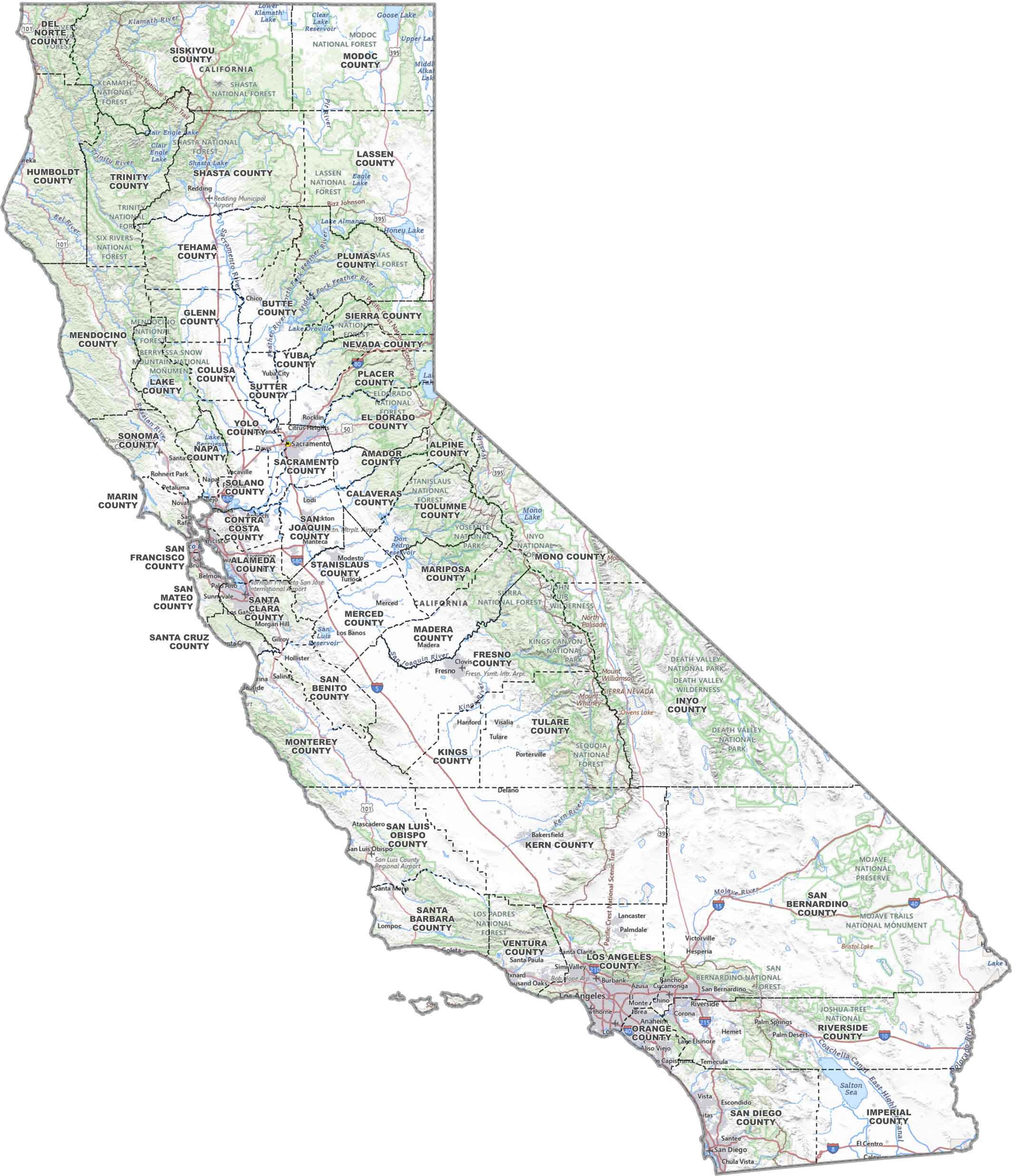
PHYSICAL MAP
California Topographic County Map
Need to see California’s lay of the land? This map keeps it simple. It has county lines, national parks, and major roads.
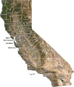
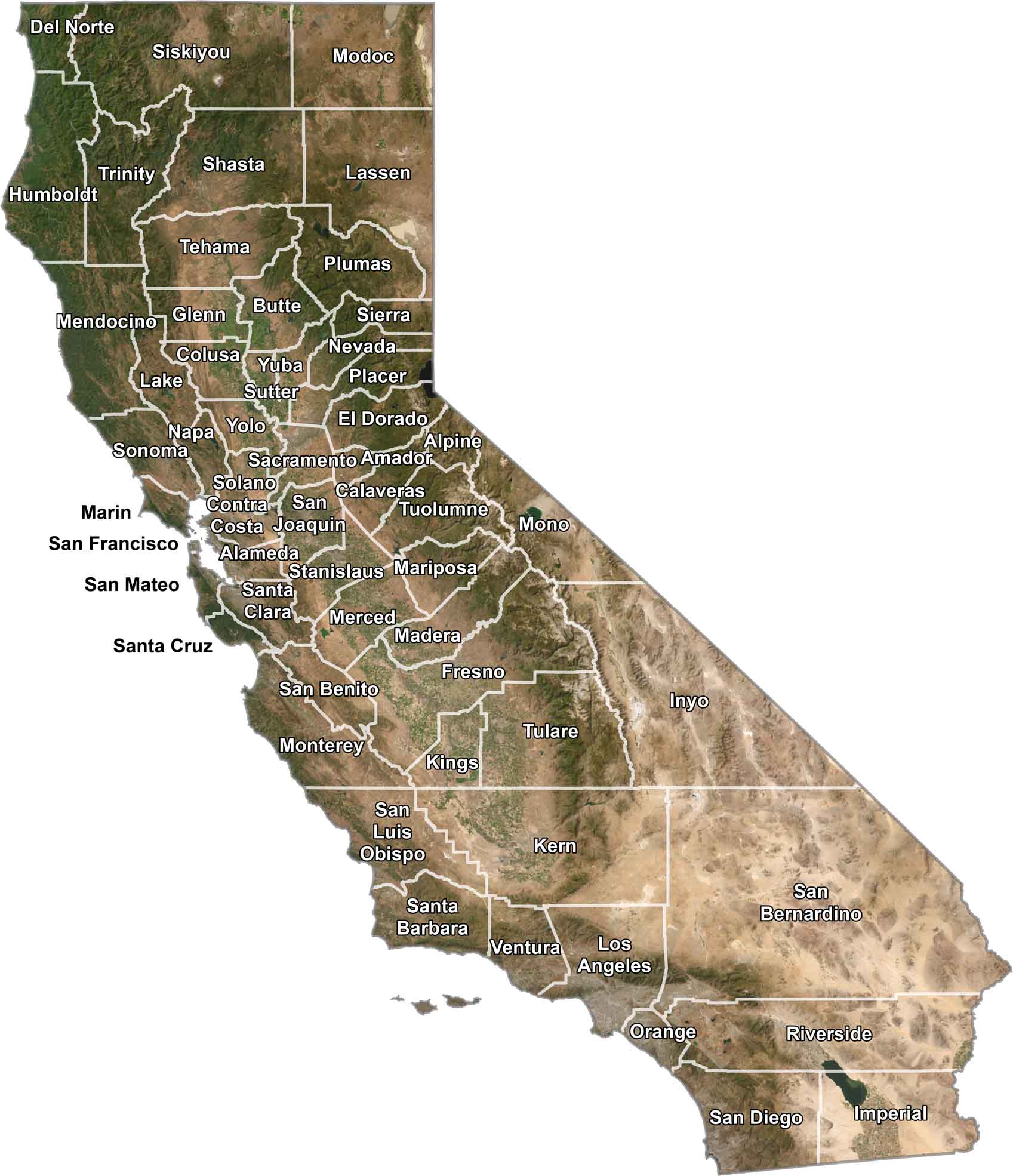
SATELLITE IMAGERY
California Satellite County Map
Our satellite map shows California from the sky. You’ll spot dusty deserts, deep green forests, and that endless Pacific coastline. County lines keep it organized, but the real story is the land itself
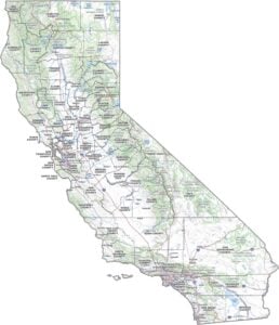
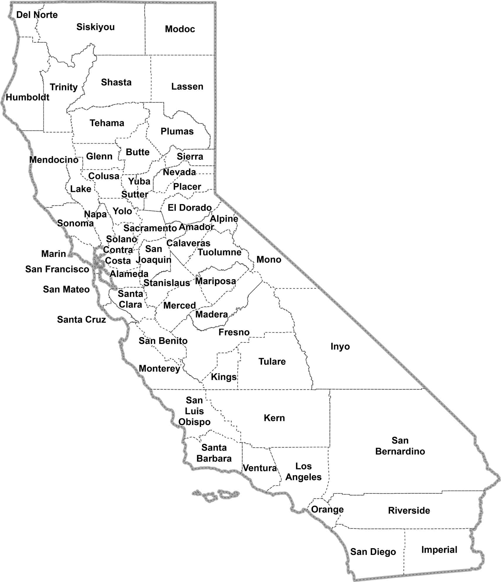
OUTLINE MAP
California Simple County Map
Need to find a county quick? This clean map gives it to you all at a glance. Print it, screenshot it, stick it on your wall. And you’re done.
California Counties
In terms of population, Los Angeles County has the most people. It’s not just big. It’s massive. We’re talking more people than most states, crammed into an area that includes glitzy Hollywood, gritty downtown LA, and everything in between. On the flip side, there’s Alpine County, in the Sierra Nevada. With fewer than 2,000 folks, it’s California’s least populous county. No big cities here. It’s just pristine wilderness with tons of elbow room.
Most Populous: Los Angeles County
Least Populous: Alpine County

For size, San Bernardino County takes the cake for size. From the Mojave Desert to the San Bernardino Mountains, this county has it all. Death Valley, the lowest point in North America? Yeah, that’s here too. Now, shrink that down to postage stamp size and you’ve got San Francisco County. It might be tiny, but it has iconic bridges, steep hills, and an island prison.
Largest Area: San Bernardino County
Smallest Area: San Francisco County
The county names in California often have Native American origins, Spanish influence, geographical features, and notable historical figures. For example, Yolo County comes from a Native American word. Yep, it doesn’t stand for “You Only Live Once”. While San Diego County honors a Spanish saint, Sutter County is named after a prominent settler.
California’s counties have some larger-than-life stories. You’ve got Napa County with its world-class wines. Humboldt County is where the redwoods touch the sky. Finally, Lake County is named for its geographical features. Yep, water. And what’s the oldest county in California? San Diego was established back in 1850 when California first became a state. Talk about getting in on the ground floor.
California County List
Here’s a straightforward list of all 58 California counties:
| FIPS Code | Name | Land % | Water % | Total Area (sq mi) |
|---|---|---|---|---|
| 06-001 | Alameda County | 89.8 | 10.2 | 821.1 |
| 06-003 | Alpine County | 99.3 | 0.7 | 743.2 |
| 06-005 | Amador County | 98.1 | 1.9 | 605.9 |
| 06-007 | Butte County | 97.6 | 2.4 | 1,677.1 |
| 06-009 | Calaveras County | 98.4 | 1.6 | 1,036.9 |
| 06-011 | Colusa County | 99.5 | 0.5 | 1,156.3 |
| 06-013 | Contra Costa County | 89.2 | 10.8 | 804.1 |
| 06-015 | Del Norte County | 81.8 | 18.2 | 1,229.7 |
| 06-017 | El Dorado County | 95.6 | 4.4 | 1,786.3 |
| 06-019 | Fresno County | 99.1 | 0.9 | 6,011.1 |
| 06-021 | Glenn County | 99.0 | 1.0 | 1,327.0 |
| 06-023 | Humboldt County | 88.1 | 11.9 | 4,052.2 |
| 06-025 | Imperial County | 93.2 | 6.8 | 4,481.7 |
| 06-027 | Inyo County | 99.6 | 0.4 | 10,226.9 |
| 06-029 | Kern County | 99.6 | 0.4 | 8,162.6 |
| 06-031 | Kings County | 99.9 | 0.1 | 1,391.5 |
| 06-033 | Lake County | 94.5 | 5.5 | 1,329.4 |
| 06-035 | Lassen County | 96.2 | 3.8 | 4,720.1 |
| 06-037 | Los Angeles County | 85.4 | 14.6 | 4,751.1 |
| 06-039 | Madera County | 99.2 | 0.8 | 2,153.2 |
| 06-041 | Marin County | 62.8 | 37.2 | 828.2 |
| 06-043 | Mariposa County | 99.0 | 1.0 | 1,462.8 |
| 06-045 | Mendocino County | 90.4 | 9.6 | 3,878.1 |
| 06-047 | Merced County | 97.8 | 2.2 | 1,978.6 |
| 06-049 | Modoc County | 93.2 | 6.8 | 4,203.2 |
| 06-051 | Mono County | 97.4 | 2.6 | 3,131.9 |
| 06-053 | Monterey County | 87.0 | 13.0 | 3,771.2 |
| 06-055 | Napa County | 94.9 | 5.1 | 788.6 |
| 06-057 | Nevada County | 98.4 | 1.6 | 973.8 |
| 06-059 | Orange County | 83.6 | 16.4 | 948.0 |
| 06-061 | Placer County | 93.7 | 6.3 | 1,502.2 |
| 06-063 | Plumas County | 97.7 | 2.3 | 2,613.4 |
| 06-065 | Riverside County | 98.7 | 1.3 | 7,303.1 |
| 06-067 | Sacramento County | 97.1 | 2.9 | 994.4 |
| 06-069 | San Benito County | 99.9 | 0.1 | 1,390.5 |
| 06-071 | San Bernardino County | 99.8 | 0.2 | 20,105.0 |
| 06-073 | San Diego County | 93.0 | 7.0 | 4,525.6 |
| 06-075 | San Francisco County | 20.2 | 79.8 | 231.9 |
| 06-077 | San Joaquin County | 97.6 | 2.4 | 1,426.7 |
| 06-079 | San Luis Obispo County | 91.3 | 8.7 | 3,615.5 |
| 06-081 | San Mateo County | 60.5 | 39.5 | 741.0 |
| 06-083 | Santa Barbara County | 72.2 | 27.8 | 3,789.1 |
| 06-085 | Santa Clara County | 99.0 | 1.0 | 1,304.0 |
| 06-087 | Santa Cruz County | 73.3 | 26.7 | 607.2 |
| 06-089 | Shasta County | 98.1 | 1.9 | 3,847.4 |
| 06-091 | Sierra County | 99.1 | 0.9 | 962.2 |
| 06-093 | Siskiyou County | 98.9 | 1.1 | 6,347.9 |
| 06-095 | Solano County | 90.7 | 9.3 | 906.2 |
| 06-097 | Sonoma County | 89.1 | 10.9 | 1,767.9 |
| 06-099 | Stanislaus County | 98.8 | 1.2 | 1,513.9 |
| 06-101 | Sutter County | 99.0 | 1.0 | 608.4 |
| 06-103 | Tehama County | 99.6 | 0.4 | 2,962.2 |
| 06-105 | Trinity County | 99.1 | 0.9 | 3,207.6 |
| 06-107 | Tulare County | 99.7 | 0.3 | 4,838.6 |
| 06-109 | Tuolumne County | 97.6 | 2.4 | 2,274.4 |
| 06-111 | Ventura County | 83.4 | 16.6 | 2,208.2 |
| 06-113 | Yolo County | 99.1 | 0.9 | 1,023.6 |
| 06-115 | Yuba County | 98.1 | 1.9 | 644.0 |
Source: United States Census Bureau