Arkansas County Map

Arkansas County Map Collection

We allow you to use our Arkansas County map. Attribution is required.
Arkansas County Maps
Arkansas is divided into 75 counties. They’re as diverse as they come. See them all in each county map below.


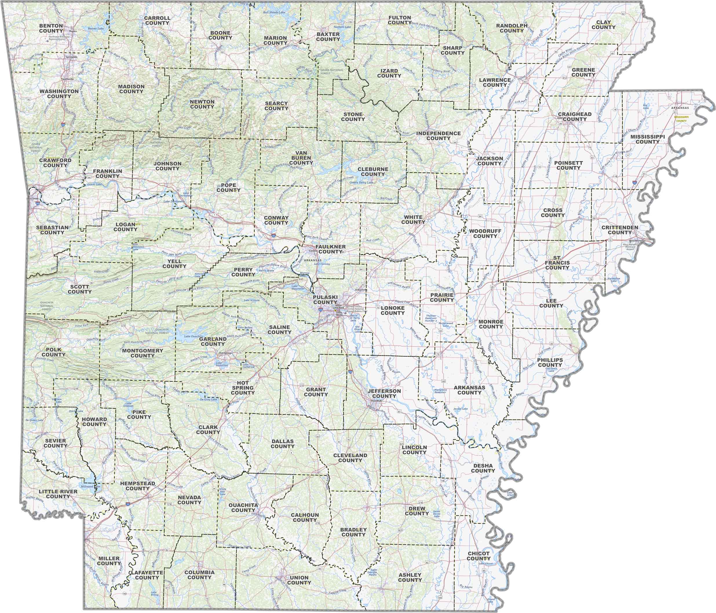
PHYSICAL MAP
Arkansas Topographic County Map
Don’t expect Arkansas to be flat from end to end. The Ozark and Ouachita Mountains cut through the western counties. But the eastern side flattens into the Mississippi Delta.
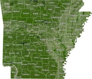
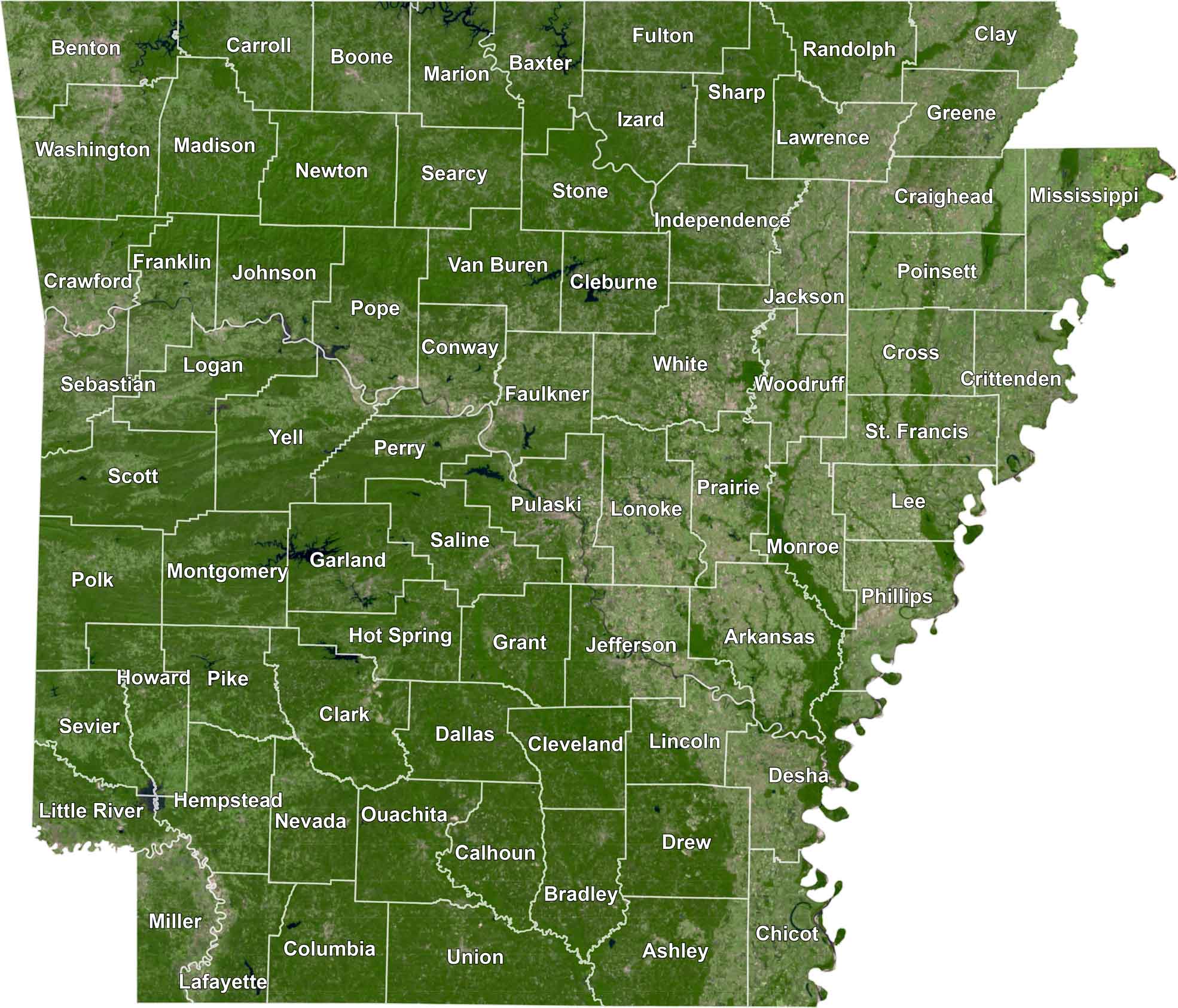
SATELLITE IMAGERY
Arkansas Satellite County Map
Explore Arkansas in detail with our satellite county map. Each county is neatly outlined, making it easy to spot cities, rivers, and highways.
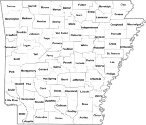
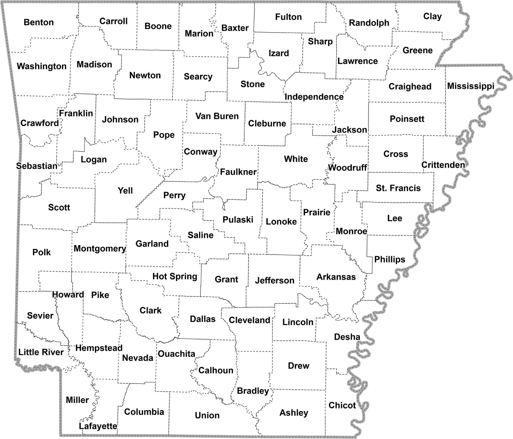
OUTLINE MAP
Arkansas Simple County Map
This simple Arkansas county map highlights all 75 counties with clean borders for easy reference. It’s just the essentials in a clean, readable design.
Arkansas Counties
In terms of population, Pulaski County is the most densely populated here. It’s home to Little Rock, the state capital. Calhoun County, in the south-central part of the state, is Arkansas’ least populous county. No mountains or deserts here. Overall, it’s just quiet pine forests and a pace of life that’s slow.
Most Populous: Pulaski County
Least Populous: Calhoun County

When it comes to size, Union County stretches out the farthest. It’s down in the southwest corner, butting up against Louisiana. In contrast, there’s Lafayette County, the state’s smallest. It might not take up much space on the map, but it has character to spare.
Largest Area: Union County
Smallest Area: Lafayette County
Arkansas’ counties are like a history book come to life. Take Washington County, for instance. It was one of the original counties when Arkansas was still a territory way back in 1818. Or look at Desha County, named after a War of 1812 hero who later became governor. And let’s not forget the counties with Native American names like Ouachita and Chicot.
Arkansas’ counties each tell a part of the state’s story. You’ve got Garland County with its hot springs, Benton County riding the Walmart wave, and Crittenden County, keeping an eye on Memphis across the river. Arkansas has this weird thing where some counties have two county seats instead of one. Story goes it’s because back in the day, folks couldn’t travel far to do county business.
Arkansas County List
Get to know the 75 counties of Arkansas in more detail with table below.
| FIPS Code | Name | Land % | Water % | Total Area (sq mi) |
|---|---|---|---|---|
| 05-001 | Arkansas County | 95.6 | 4.4 | 1,033.7 |
| 05-003 | Ashley County | 98.4 | 1.6 | 940.5 |
| 05-005 | Baxter County | 94.5 | 5.5 | 586.7 |
| 05-007 | Benton County | 95.9 | 4.1 | 883.9 |
| 05-009 | Boone County | 98.0 | 2.0 | 602.0 |
| 05-011 | Bradley County | 99.4 | 0.6 | 652.9 |
| 05-013 | Calhoun County | 99.4 | 0.6 | 632.4 |
| 05-015 | Carroll County | 98.6 | 1.4 | 638.6 |
| 05-017 | Chicot County | 93.3 | 6.7 | 690.8 |
| 05-019 | Clark County | 98.1 | 1.9 | 882.8 |
| 05-021 | Clay County | 99.7 | 0.3 | 641.4 |
| 05-023 | Cleburne County | 93.5 | 6.5 | 591.9 |
| 05-025 | Cleveland County | 99.8 | 0.2 | 598.7 |
| 05-027 | Columbia County | 99.9 | 0.1 | 766.7 |
| 05-029 | Conway County | 97.5 | 2.5 | 566.7 |
| 05-031 | Craighead County | 99.2 | 0.8 | 712.7 |
| 05-033 | Crawford County | 98.0 | 2.0 | 603.2 |
| 05-035 | Crittenden County | 95.9 | 4.1 | 636.4 |
| 05-037 | Cross County | 99.0 | 1.0 | 622.3 |
| 05-039 | Dallas County | 99.9 | 0.1 | 668.1 |
| 05-041 | Desha County | 93.7 | 6.3 | 819.5 |
| 05-043 | Drew County | 99.1 | 0.9 | 835.7 |
| 05-045 | Faulkner County | 97.6 | 2.4 | 664.1 |
| 05-047 | Franklin County | 98.3 | 1.7 | 619.6 |
| 05-049 | Fulton County | 99.7 | 0.3 | 620.3 |
| 05-051 | Garland County | 92.3 | 7.7 | 734.6 |
| 05-053 | Grant County | 99.8 | 0.2 | 632.9 |
| 05-055 | Greene County | 99.7 | 0.3 | 579.5 |
| 05-057 | Hempstead County | 98.2 | 1.8 | 741.2 |
| 05-059 | Hot Spring County | 98.9 | 1.1 | 622.2 |
| 05-061 | Howard County | 98.9 | 1.1 | 595.3 |
| 05-063 | Independence County | 99.0 | 1.0 | 771.5 |
| 05-065 | Izard County | 99.4 | 0.6 | 584.0 |
| 05-067 | Jackson County | 98.8 | 1.2 | 641.5 |
| 05-069 | Jefferson County | 95.2 | 4.8 | 913.8 |
| 05-071 | Johnson County | 96.7 | 3.3 | 682.7 |
| 05-073 | Lafayette County | 96.9 | 3.1 | 545.1 |
| 05-075 | Lawrence County | 99.2 | 0.8 | 592.3 |
| 05-077 | Lee County | 97.3 | 2.7 | 619.5 |
| 05-079 | Lincoln County | 98.1 | 1.9 | 572.2 |
| 05-081 | Little River County | 94.2 | 5.8 | 564.8 |
| 05-083 | Logan County | 96.8 | 3.2 | 731.5 |
| 05-085 | Lonoke County | 96.0 | 4.0 | 802.8 |
| 05-087 | Madison County | 99.7 | 0.3 | 837.1 |
| 05-089 | Marion County | 93.2 | 6.8 | 640.3 |
| 05-091 | Miller County | 98.1 | 1.9 | 637.6 |
| 05-093 | Mississippi County | 97.9 | 2.1 | 919.8 |
| 05-095 | Monroe County | 97.7 | 2.3 | 621.3 |
| 05-097 | Montgomery County | 97.4 | 2.6 | 800.3 |
| 05-099 | Nevada County | 99.5 | 0.5 | 620.6 |
| 05-101 | Newton County | 99.7 | 0.3 | 823.2 |
| 05-103 | Ouachita County | 99.1 | 0.9 | 739.7 |
| 05-105 | Perry County | 98.4 | 1.6 | 560.5 |
| 05-107 | Phillips County | 95.6 | 4.4 | 727.3 |
| 05-109 | Pike County | 97.8 | 2.2 | 614.1 |
| 05-111 | Poinsett County | 99.3 | 0.7 | 763.6 |
| 05-113 | Polk County | 99.4 | 0.6 | 862.5 |
| 05-115 | Pope County | 97.8 | 2.2 | 830.8 |
| 05-117 | Prairie County | 95.9 | 4.1 | 675.6 |
| 05-119 | Pulaski County | 94.0 | 6.0 | 807.7 |
| 05-121 | Randolph County | 99.4 | 0.6 | 656.0 |
| 05-123 | St. Francis County | 98.8 | 1.2 | 642.5 |
| 05-125 | Saline County | 99.0 | 1.0 | 730.5 |
| 05-127 | Scott County | 99.4 | 0.6 | 898.0 |
| 05-129 | Searcy County | 99.6 | 0.4 | 668.5 |
| 05-131 | Sebastian County | 97.2 | 2.8 | 547.2 |
| 05-133 | Sevier County | 97.2 | 2.8 | 581.3 |
| 05-135 | Sharp County | 99.7 | 0.3 | 606.4 |
| 05-137 | Stone County | 99.5 | 0.5 | 609.4 |
| 05-139 | Union County | 98.5 | 1.5 | 1,055.2 |
| 05-141 | Van Buren County | 98.0 | 2.0 | 724.3 |
| 05-143 | Washington County | 98.9 | 1.1 | 952.4 |
| 05-145 | White County | 99.3 | 0.7 | 1,042.1 |
| 05-147 | Woodruff County | 98.8 | 1.2 | 594.0 |
| 05-149 | Yell County | 98.0 | 2.0 | 948.9 |
Source: United States Census Bureau